Maysville in Mason County, Kentucky — The American South (East South Central)
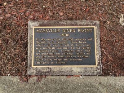
Maysville River Front 1900
— Early 1900's —
It's the turn of the 19th/20th centuries, and Maysville is in transition. Horse-drawn vehicles will soon vie with the town's first auto; riverboats will come, but the railroad is growing busier. Downtown thrives with new businesses and buildings. Buffalo Bill and John Phillip Sousa came to the Opera House; Casey Stengel and showboats entertained our citizens.
Erected 1998 by Maysville-Mason County Area Chamber of Commerce, Limestone Economic Development, Inc.
Topics. This historical marker is listed in these topic lists: Entertainment • Industry & Commerce • Railroads & Streetcars • Waterways & Vessels.
Location. 38° 38.884′ N, 83° 45.761′ W. Marker is in Maysville, Kentucky, in Mason County. Marker can be reached from the intersection of East McDonald Parkway and Cherry Alley. Touch for map. Marker is at or near this postal address: 25 East McDonald Parkway, Maysville KY 41056, United States of America. Touch for directions.
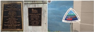
Other nearby markers. At least 8 other markers are within walking distance of this marker. Underground Rail Road (a few steps from this marker); Front Street Maysville, 1850 (within shouting distance of this marker); La Fayette's Visit to Maysville (within shouting distance of this marker); Limestone Landing (within shouting distance of this marker); Buffalo Trace (within shouting distance of this marker); Lewis and Clark in Kentucky / John Colter (ca. 1775-1813) (within shouting distance of this marker); Maysville Shipbuilding / "Maysville's" Voyaging (within shouting distance of this marker); Mason County Spy Company (about 300 feet away, measured in a direct line). Touch for a list and map of all markers in Maysville.
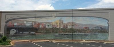
Regarding Maysville River Front 1900. The gold and brown tones of autumn provide the backdrop for this panel showing the communities continued growth with housing and business development along Water Street.
Transportation has progressed with the introduction of the railway system.
This changed Maysville’s sole reliance on the river by providing both freight and passenger transportation adding to the communities economic prosperity.
Credits. This page was last revised on June 16, 2016. It was originally submitted on June 1, 2015, by Mark Hilton of Montgomery, Alabama. This page has been viewed 430 times since then and 28 times this year. Photos: 1, 2, 3. submitted on June 1, 2015, by Mark Hilton of Montgomery, Alabama.


