Lamia in Fthiótida, Thessaly and Central Greece, Greece — Ελλάδα (Southeastern Europe, Balkan Peninsula)
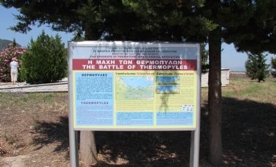
The Battle of Thermopyles
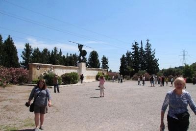
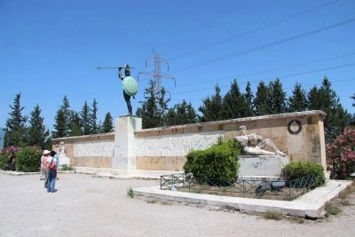
In the year 480 B.C. in this sacred place called Thermopyles was carried out the most astonishing and unequal battle between few Greeks and a million of Persians. This battle is a landmark in the World’s History.
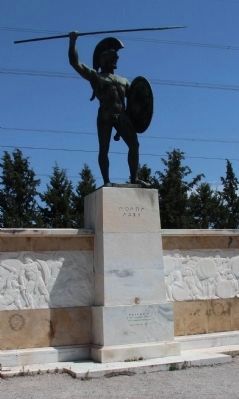
Three hundred Spartans and seven hundred Thespians under the orders of Leonidas, king of Sparta, decided to fight against the Persians and win or die defending the freedom of their country. According to the historian Herodotus, the Persian army consisted of about one million seven hundred thousand soldiers who were under the command of King Xerxes.
The Persians asked the defenders to give up their arms, but Leonidas replied to them with the heroic phrase come and get them. This phrase has been, and will always be, a bright example for generations to come, of one’s doing his duty for his country.
On Kolonos an epitaph was placed to honor the dead soldiers. The epitaph has the following message engraved on: <<You stranger, go to Lakedaimonians and let them know that we lie here, faithful to their laws>>.
During the 1st century A.D., the philosopher Apollonios Tyanefs visited Thermopyles. Someone asked him which was the highest mountain in the world. He answered: <<Kolonos is the highest mountain in the world, because on this mountain the law keeping and the noble self-sacrifice have put up a monument, which has its base on the earth and reaches the stars>>.
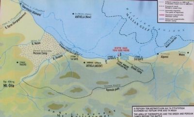
The caption for picture #1:
The Persian Camp is between the rivers Melas and Asopos. In ancient times the difficultly accessible pass had three gates (the ancient and the modern coast line are marked on the map).The Phokian Wall, behind which the small Greek camp was settled, protected the second gate. One should notice on the map the path of Anopaia through which the Greek troops were surrounded.
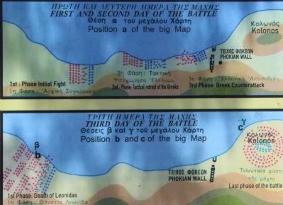
The caption for picture #2:
The Persians invade and reach the second gate. However they are crushed by the Greeks after a tough and deadly battle, which lasted two days.
On the third day of the battle a Greek traitor called Ephialtes led the special forces of Hydarnes through the path of Anopaia to the rear of the Greek troops. After a desperate fight the Spartan leader died. The rest of the Greeks, who had escaped death defending themselves, retreated to the hill of Kolonos (right). There, all of them fell bravely.
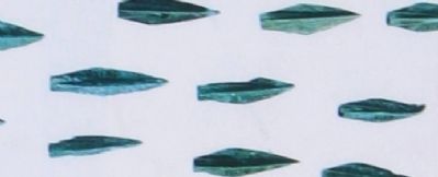
The caption for picture #3:
Persian arrowheads found in hundreds on Kolonos hill (Athens, National Archaeological Museum).
Topics. This memorial is listed in this topic list: Notable Events.
Location. 38° 47.779′
N, 22° 32.169′ E. Marker is in Lamia, Thessaly and Central Greece, in Fthiótida. Memorial is on Palea Ethniki Odos Athinon Thessalonikis west of The National Road (National Route E75), on the right when traveling west. Coming from Athens on National Highway Road to Lamia, after the tollpost of Agia Triada, we take the route right, to the Local Community of Thermopylae, and continue traveling a short distance beyond the town, until you arrive at the Memorial of Leonidas and Sparta 300. The marker is located just to the left (west) of the memorial. Touch for map. Marker is in this post office area: Lamia, Thessaly and Central Greece 350 09, Greece. Touch for directions.
Other nearby markers. At least 1 other marker is within walking distance of this marker. Kolonos Hill Memorial (about 90 meters away, measured in a direct line).
Also see . . . Thermopylae's Innovative Centre of Historical Information. This is a link to information provided by the Cultural and Tourism Hoard of the Municipality of Lamia. (Submitted on June 24, 2015, by Dale K. Benington of Toledo, Ohio.)
Credits. This page was last revised on March 22, 2022. It was originally submitted on June 15, 2015, by Dale K. Benington of Toledo, Ohio. This page has been viewed 1,261 times since then and 109 times this year. Photos: 1, 2, 3, 4, 5, 6, 7. submitted on June 24, 2015, by Dale K. Benington of Toledo, Ohio.
