Farmington in Oakland County, Michigan — The American Midwest (Great Lakes)
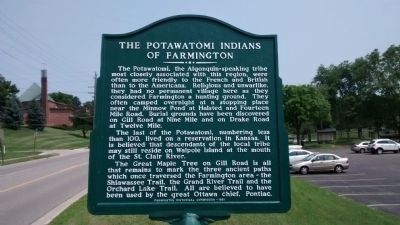
The Potawatomi Indians of Farmington
The last of the Potawatomi, numbering less than 100, lived on a reservation in Kansas. It is believed that descendants of the local tribe may still reside on Walpole Island at the mouth of the St. Clair River.
The Great Maple Tree on Gill Road is all that remains to mark the three ancient paths which once traversed the Farmington area - the Shiawasee Trail, the Grand River Trail and the Orchard Lake Trail. All are believed to have been used by the great Ottawa chief, Pontiac.
Erected 1981 by Farmington Historical Commission.
Topics. This historical marker is listed in this topic list: Native Americans.
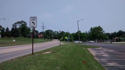
Location. 42° 27.946′ N, 83° 22.221′ W. Marker is in Farmington, Michigan, in Oakland County. Marker is on Shiawassee Street west of Raphael Road, on the right when traveling east. Marker is in Shiawassee Park. Touch for map. Marker is in this post office area: Farmington MI 48336, United States of America. Touch for directions.
Other nearby markers. At least 8 other markers are within walking distance of this marker. Methodist Episcopal Church (approx. ¼ mile away); Travel Through Time (approx. ¼ mile away); Heeney-Sundquist Funeral Home, Inc. (approx. 0.3 miles away); Farmington Masonic Temple and Farmington Township Hall (approx. 0.3 miles away); The Village Center (approx. 0.3 miles away); Farmington's First Post Office (approx. 0.3 miles away); Kirby White House (approx. 0.4 miles away); First Quaker Meeting (approx. 0.4 miles away). Touch for a list and map of all markers in Farmington.
Credits. This page was last revised on June 16, 2016. It was originally submitted on July 9, 2015, by Joel Seewald of Madison Heights, Michigan. This page has been viewed 1,143 times since then and 128 times this year. Photos: 1, 2. submitted on July 9, 2015, by Joel Seewald of Madison Heights, Michigan. • Bill Pfingsten was the editor who published this page.

