Old Westport in Kansas City in Jackson County, Missouri — The American Midwest (Upper Plains)
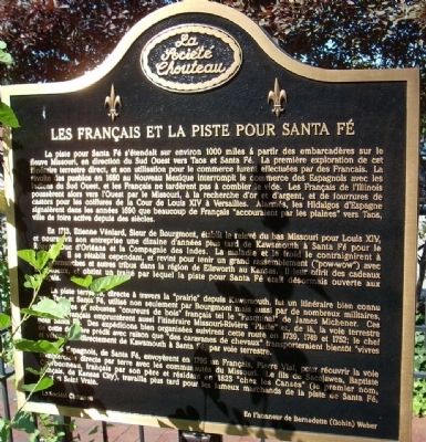
The French and the Santa Fe Trail
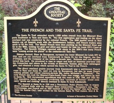
The Santa Fe Trail extended nearly 1,000 miles overall from the Missouri River ports Southwest to Taos and Santa Fe. The first exploration and trading on the direct overland trail was conducted by the colonial French. The 1680 pueblo revolt in New Mexico cut off Spanish trade with the Southwestern Indians, and French traders were quick to fill the void. The Illinois French were then pushing up the Missouri River and far to the West, looking for gold and silver - and beaver for hats for Louis XIV's Court at Versailles. The Spanish Hidalgos reported with alarm in the 1690's that many French were "coming across the plains" to the centuries-old Taos Fair.
Etienne Veniard, Sieur de Bourgmont, surveyed the lower Missouri for Louis XIV in 1713, and set out overland from Kawsmouth to Santa Fe for the Regent, the Duc d'Orleans, and the Company of the Indies a decade later. Sickness and cold weather turned him back. He recovered in time to return and hold an immense pow-wow with the Comanches and others in the vicinity of Ellsworth, Kansas, gave them extravagant gifts, and obtained a treaty which opened the Santa Fe Trail to the French.
The direct overland prairie journey from Kawsmouth was a well-known French route to Taos and Santa Fe, used not only by Bourgmont, but also by many French military, priests and robust coureurs-de-bois like James Michener's "Pasquinal." The early French also took the Missouri-Platte-South Platte river voyage, and thence by land to Santa Fe. Well documented expeditions took this route in 1739, 1749, and 1752; the 1752 expedition leader accurately predicting that "caravans of horses" would soon carry "goods and clothing" directly overland to Santa Fe from Kawsmouth.
The Spanish at Santa Fe in 1795 sent a Frenchman, Pedro (Pierre) Vial, to reopen direct overland trade with the Missouri River communities. Sacajawae's son, "Bap" Charbonneau, part French and an 1823 resident of "Chez les Canses" (the early French name for Kansas City), later worked for the famous Santa Fe Trail traders, Bent & St. Vrain.
Erected by Chouteau Society.
Topics and series. This historical marker is listed in these topic lists: Native Americans • Settlements & Settlers. In addition, it is included in the Santa Fe Trail series list. A significant historical year for this entry is 1680.
Location. 39° 3.162′ N, 94° 35.494′ W. Marker is in Kansas City, Missouri, in Jackson County. It is in Old Westport. Marker is at the intersection of Westport Road and Pennsylvania Avenue on Westport Road. Touch for map. Marker is in this post office area: Kansas City MO 64111, United States of America. Touch for directions.
Other nearby markers. At least 8 other markers are within walking distance of this marker. McCoy's Trading Post (here, next to this marker);
The Albert G. Boone Store (within shouting distance of this marker); Original Site of Harris House (within shouting distance of this marker); Action Before Westport (within shouting distance of this marker); Three Trails West (about 400 feet away, measured in a direct line); Alexander Majors (about 400 feet away); John Calvin McCoy (about 400 feet away); James Bridger (about 400 feet away). Touch for a list and map of all markers in Kansas City.
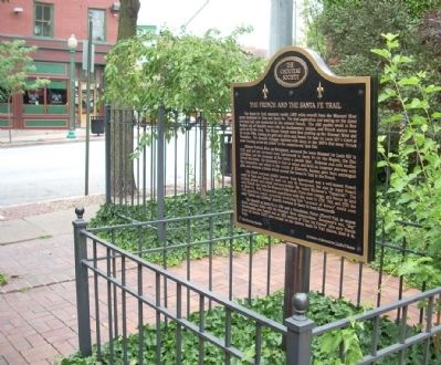
More about this marker. This marker is in a small pocket park just to the southwest of intersection of Westport Road and Pennsylvania Avenue. Westport is a major entertainment area and parking is at a premium on Friday and Saturday nights. As of July 27, 2015, a building is being erected on the site where the marker once stood. It is not certain where the marker will be placed once construction is finished.
Also see . . .
1. Santa Fe National Historical Trail. National Park Service website entry (Submitted on July 25, 2009, by Thomas Onions of Olathe, Kansas.)
2. Chouteau Society. Jackson County Historical Society website entry (Submitted on July 25, 2009, by Thomas Onions of Olathe, Kansas.)
3. Santa Fe Trail – Highway to the Southwest. Legends of America website entry (Submitted on July 25, 2009, by Thomas Onions of Olathe, Kansas.)
4. Westport Historical Society. Society website homepage (Submitted on July 25, 2009, by Thomas Onions of Olathe, Kansas.)
Additional keywords. Santa Fe Trail
Credits. This page was last revised on February 10, 2023. It was originally submitted on July 25, 2009, by Thomas Onions of Olathe, Kansas. This page has been viewed 2,572 times since then and 31 times this year. Last updated on July 26, 2015, by Michael W. Kruse of Kansas City, Missouri. Photos: 1, 2, 3. submitted on July 25, 2009, by Thomas Onions of Olathe, Kansas. 4. submitted on September 11, 2009, by Thomas Onions of Olathe, Kansas. • Bill Pfingsten was the editor who published this page.


