Near Richmond in Madison County, Kentucky — The American South (East South Central)
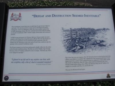
"Defeat and Destruction Seemed Inevitable"
As Hill's troops advanced, Col. Thomas McCrary's Texans made one more assault on the Federal line along Duncannon Road. This time the resolve of the veteran Confederates was too much for Cruft's tired men. The 12th Indiana and 18th Kentucky on the west end of Cruft's line could not take the pressure of the renewed Confederate attack.
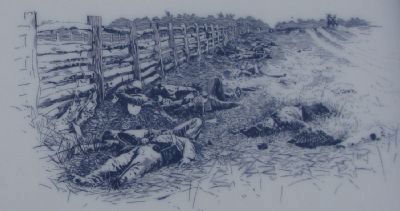
The Texans jumped over the fence and poured a deadly volley into the ranks of the Hoosiers and Kentuckians. The fire was awful. Finally, Capt. George Bowman of the 12th Indiana ordered his men to retreat, "Fall back, boys, there's no use staying here any longer."
"I glanced to my left and to my surprise saw that, with one exception, only a line of dead or wounded remained." Pvt. David G. LeSourd, 12th Indiana
The Union line was cut to pieces. The 18th Kentucky lost its colonel and several other officers were killed or wounded. The withdrawal of the inexperienced Union troops degenerated into a panic. Cruft ordered his last two regiments to block Hill's assault. The result was disastrous. The 95th Ohio, which had been battered at Mt. Zion Church, broke before firing a shot. When the Buckeyes fled, the 66th Indiana was caught in a crossfire and they, too, ran for the rear.
The race for Richmond had begun.
Erected by Civil War Discovery Trail.
Topics. This historical marker is listed in this topic list: War, US Civil.
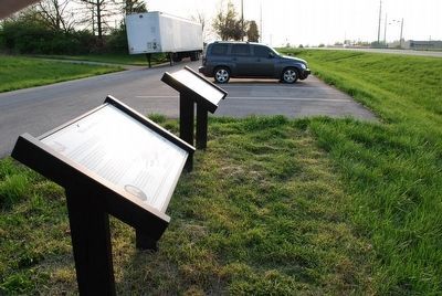
Location. 37° 42.015′ N, 84° 15.875′ W. Marker is near Richmond, Kentucky, in Madison County. Marker is on Duncannon Road, 0.1 miles west of Berea Road (U.S. 25/421), on the right when traveling east. Marker is located on a small service road just West of the intersection. Several other related markers are also located in this area. Touch for map. Marker is in this post office area: Richmond KY 40475, United States of America. Touch for directions.
Other nearby markers. At least 8 other markers are within walking distance of this marker. "Rally, boys! Rally to the Colors!" (here, next to this marker); The Battle of Richmond (a few steps from this marker); The Generals (a few steps from this marker); Battle of Richmond, Ky. (approx. 0.9 miles away); Twitty's or Little Fort (approx. 0.9 miles away); Fort Estill (approx. 0.9 miles away); Daniel Boone's Trace (approx. 0.9 miles away); Daniel Boone's Trail (approx. 0.9 miles away). Touch for a list and map of all markers in Richmond.
Credits. This page was last revised on June 16, 2016. It was originally submitted on June 2, 2010, by Lee Hattabaugh of Capshaw, Alabama. This page has been viewed 981 times since then and 11 times this year. Last updated on July 27, 2015, by Brandon Fletcher of Chattanooga, Tennessee. Photos: 1, 2. submitted on June 2, 2010, by Lee Hattabaugh of Capshaw, Alabama. 3. submitted on July 27, 2015, by Brandon Fletcher of Chattanooga, Tennessee. • Bill Pfingsten was the editor who published this page.


