Salem in Essex County, Massachusetts — The American Northeast (New England)
Central Wharf
Salem Maritime National Historical Site
— National Park Service, U.S. Department of the Interior —
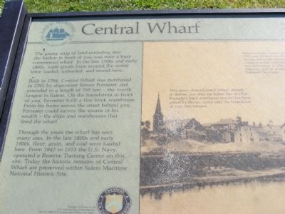
Through the years the wharf has seen many uses. In the late 1800s and early 1900s, flour, grain, and coal were loaded here. From 1947 to 1973 the U.S. Navy operated a Reserve Training Center on this site. Today the historic remains of Central Wharf are preserved within Salem Maritime National Historic Site.
Erected by National Park Service.
Topics. This historical marker is listed in these topic lists: Industry & Commerce • Waterways & Vessels. A significant historical year for this entry is 1784.
Location. Marker has been reported missing. It was located near 42° 31.236′ N, 70° 53.238′ W. Marker was in Salem, Massachusetts, in Essex
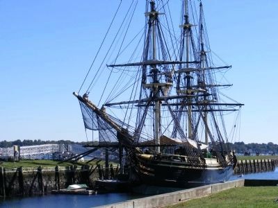
Other nearby markers. At least 8 other markers are within walking distance of this location. Wharves in the Early 1800s (within shouting distance of this marker); Pedrick Store House, 1770 (within shouting distance of this marker); a different marker also named Central Wharf (within shouting distance of this marker); Salem Maritime National Historic Site (within shouting distance of this marker); Wharves in the late 1800's (within shouting distance of this marker); Friendship of Salem (within shouting distance of this marker); a different marker also named Friendship of Salem (about 300 feet away, measured in a direct line); Derby Wharf (about 300 feet away). Touch for a list and map of all markers in Salem.
More about this marker. This marker has been replaced by a recently submitted marker of the same name but with different text.
Credits. This page was last revised on June 16, 2016. It was originally submitted on January 11, 2013, by Don Morfe of Baltimore, Maryland. This page has been viewed 425 times since then and 15 times this year. Last updated on July 29, 2015, by J. Makali Bruton of Accra, Ghana. Photos: 1, 2, 3. submitted on January 11, 2013, by Don Morfe of Baltimore, Maryland. • Bill Pfingsten was the editor who published this page.


