Hanover in York County, Pennsylvania — The American Northeast (Mid-Atlantic)
The Turning Point
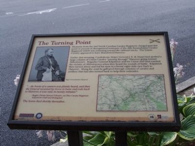
Earlier that morning, Confederate Major General J.E.B. Stuart had spotted a large column of Union Cavalry "passing through" Hanover going toward Abbottstown. Brigadier General Kilpatrick and his Union staff had reached the vicinity of Abbottstown when they heard the sounds of battle. Kilpatrick then turned about and led his men in a brutal eight-mile race back to Hanover. Along the road he galloped through columns of cavalry and artillery that had also turned back to help their comrades.
"...the boom of a cannon was plainly heard, and then the General mounted his horse in haste and rode back to Hanover, it was said, in twenty minutes."
Bugler, Private Samuel Gillespie, 1st Ohio Cavalry Regiment Kilpatrick's Staff and Bodyguard
The horse died shortly thereafter.
Topics and series. This historical marker is listed in this topic list: War, US Civil. In addition, it is included in the Pennsylvania, Battle of Hanover Walking Tour series list.
Location. 39° 48.256′ N, 76° 58.85′ W. Marker is in Hanover, Pennsylvania, in York County. Marker is at the intersection of Broadway (Pennsylvania Route 194) and North Street, on the right when traveling north on Broadway. Touch for map. Marker is in this post office area: Hanover PA 17331, United States of America. Touch for directions.
Other nearby markers. At least 8 other markers are within walking distance of this marker. Warfare Engulfs Downtown (about 300 feet away, measured in a direct line); Titans of Hanover Industry (about 500 feet away); Veterans Memorial (about 600 feet away); Former United States Post Office (approx. 0.2 miles away); The Confederates Take Stock (approx. 0.2 miles away); Abbottstown Street/Broadway (approx. 0.2 miles away); The Aftermath & Stench of Death (approx. 0.2 miles away); Abraham Lincoln (approx. ¼ mile away). Touch for a list and map of all markers in Hanover.
More about this marker. In the upper right is a portrait of Major General Judson Kilpatrick. To the lower right is a map from the Official Military Atlas of the Civil War.
Credits. This page was last revised on June 16, 2016. It was originally submitted on June 29, 2008, by Bill Pfingsten of Bel Air, Maryland. This page has been viewed 1,402 times since then and 9 times this year. Photo 1. submitted on June 29, 2008, by Bill Pfingsten of Bel Air, Maryland.
