Beallsville in Dickerson in Montgomery County, Maryland — The American Northeast (Mid-Atlantic)
Brewer Farmstead
Family Farming
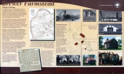
Dr. William Brewer acquired 583 acres in a land grant known as “Woodstock Manor,” in 1838. Woodstock was two miles from Dr. Brewer's primary residence, Aix-La-Chappell where he provided medical treatment to the local community and taught future physicians, including his son, Nicholas.
An avid farmer, Dr. Brewer was dedicated; to promoting agrarian improvements, such as crop rotation and the creation of local and state agricultural societies. Dr. Brewer promoted the cultivation of wheat to replace the inefficiencies created by the dominant tobacco culture in Montgomery County.
However, when Dr. Brewer's youngest son, George, established residence at Woodstock in 1850, he cultivated tobacco along with wheat. These crops were tended by enslaved persons owned by the Brewer family until 1864, when all slaves in Maryland were emancipated. At that time, two men and three women from this farm acquired their freedom.
By 1879, hired laborers worked for William George Brewer, son of George Brewer, and sole owner of the 400-acre farm. On his improved fields, he grew wheat, Indian corn, Irish potatoes, apple trees, and hay. He also maintained horses, cattle, swine and chickens. His hens laid over 350 eggs in 1880.
After tending the farm for over sixty years, William G. Brewer sold Woodstock in 1942, ending the family's farming tradition that had lasted 104 years.
Farmyard Structures
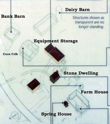
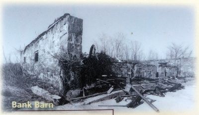
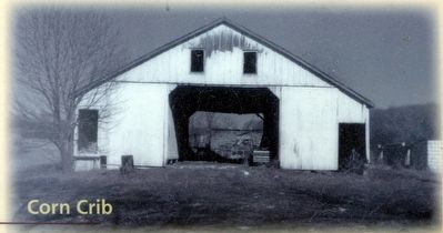
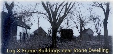
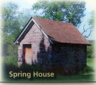
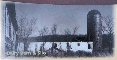
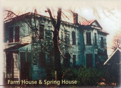
At its peak of operations this property included collection of 19th and 20th century buildings. All out-buildings, ranging slave quarters to several barns, sat directly behind the main house.
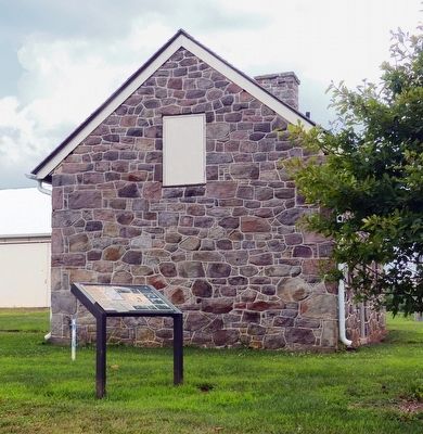
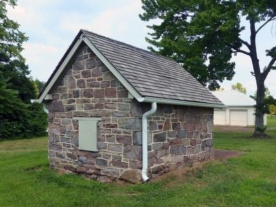
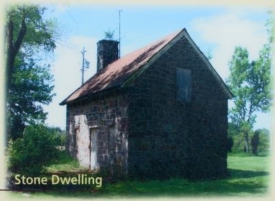
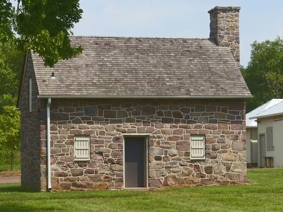
The spring house and the stone dwelling were built in the mid-19th century with Seneca sandstone, a material that ensured their longevity.
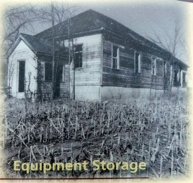
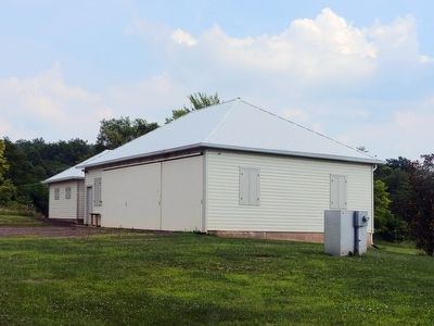
The three wood frame buildings reflect the growing mechanization of this farm in the early 20th century.
Erected by Montgomery Parks.
Topics. This historical marker is listed in this topic list: Agriculture. A significant historical year for this entry is 1838.
Location. 39° 11.432′ N, 77° 25.233′ W. Marker is in Dickerson, Maryland, in Montgomery County. It is in Beallsville. Marker is on Darnestown Road (Maryland Route 28) 1.1 miles north of Beallsville Road (Maryland Route 109), on the right when traveling north. In the Woodstock Equestrian Park, 20207 Darnestown Road On Rte. 28, 3/4 mile North of Beallsville. Touch for map. Marker is at or near this postal address: 20207 Darnestown Road, Dickerson MD 20842, United States of America. Touch for directions.
Other nearby markers. At least 8 other markers are within walking distance of this marker. Equestrian Heritage (within shouting distance of this marker); African American Soldiers from Montgomery County (about 600 feet away, measured in a direct line); Washington's Farm (approx. 0.7 miles away); In Loving Memory (approx. 0.8 miles away); The Country Store (approx. 0.8 miles away); The Darby Store (approx. 0.8 miles away); The Darby Family (approx. 0.8 miles away); Beallsville (approx. 0.9 miles away). Touch for a list and map of all markers in Dickerson.
Photographed By Allen C. Browne, July 26, 2015
3. Brewer Homes
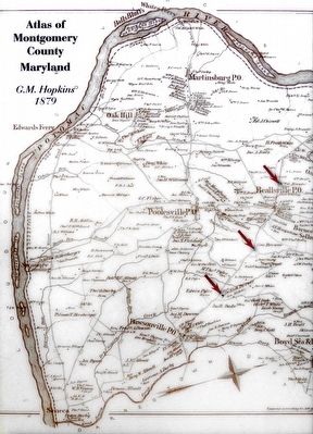
The extended Brewer family lived in close proximity within the Medley District: William lived at Woodstock; his father; George, occupied Aix-La-Chapelle; and his uncle, Nicholas, maintained a residence at Greenwood. These properties still stand today directly off Darnestown Road.Close-up of map on marker
Photographed By Allen C. Browne, July 26, 2015
4. Fifteen Dollar Reward
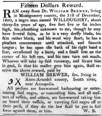
The toil of enslaved African Americans ensured the productivity of the Brewer farm. A slave was a very valuable asset. This runaway ad from 1800, for the return of the runaway Willoughby, a bondsman owned by Dr. William Brewer, shows the lengths to which a master would go to recover his property. Close-up of image on marker
Credits. This page was last revised on February 21, 2023. It was originally submitted on August 9, 2015, by Allen C. Browne of Silver Spring, Maryland. This page has been viewed 714 times since then and 89 times this year. Photos: 1, 2, 3, 4, 5, 6, 7, 8, 9, 10, 11, 12, 13, 14, 15, 16. submitted on August 9, 2015, by Allen C. Browne of Silver Spring, Maryland. • Bill Pfingsten was the editor who published this page.
