Guernsey in Platte County, Wyoming — The American West (Mountains)
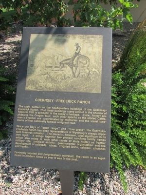
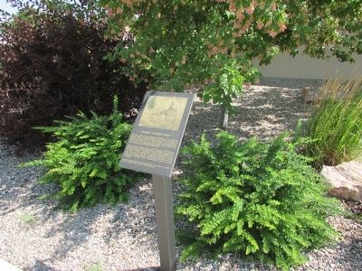
Guernsey – Frederick Ranch
The sight centers on the headquarters buildings of the Guernsey-Frederick Ranch. That these building stand almost in the shadow of Register Cliff is symbolic of the valley’s heritage. Here, history emphasizes the Oregon Trail; such other epochs as the storied Cattleman’s Frontier are subordinated by memories and the visual landmarks of that nationally famous emigrant road.
Since the days of “open range” and “free grass” the Guernsey-Frederick Ranch has been representative of Wyoming’s always important livestock industry. The place is, however, also significant in its own right. It brings together two pioneer ranching family names which also relate to such other facets of state history as frontier military life, political activity, governmental organization and the development of railroads, mines, irrigated lands, schools, churches and banks.
Favorably located and progressively operated, the ranch is as significant in modern times as ever it was in the past.
Topics. This historical marker is listed in these topic lists: Roads & Vehicles • Settlements & Settlers.
Location. 42° 16.148′ N, 104° 44.477′ W. Marker is in Guernsey, Wyoming, in Platte County. Marker is on S Wyoming Avenue, on the left when traveling south. Touch for map. Marker is in this post office area: Guernsey WY 82214, United States of America. Touch for directions.
Other nearby markers. At least 8 other markers are within walking distance of this marker. Sand Point (here, next to this marker); Laramie Peak (here, next to this marker); The Burlington – Northern Railroad (here, next to this marker); Register Cliffs (here, next to this marker); Guernsey Pipeline Station (here, next to this marker); North Platte River (a few steps from this marker); Fort Laramie (a few steps from this marker); Mexican Hill (a few steps from this marker). Touch for a list and map of all markers in Guernsey.
Credits. This page was last revised on June 16, 2016. It was originally submitted on August 9, 2015, by Bill Coughlin of Woodland Park, New Jersey. This page has been viewed 409 times since then and 34 times this year. Photos: 1, 2, 3. submitted on August 9, 2015, by Bill Coughlin of Woodland Park, New Jersey.


