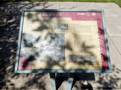
Lock No. 2
Lehigh Coal and Navigation Company
— 1832-1931 —
Progress
Canal boats continued to pass through Bristol for years after the Pennsylvania Railroad built a line nearby. Progress, in the form of the Railroad undermined the business of the Canal and led to the eventual demolition of its channel, lock, locktenders house, and lock shanty, as well as a blacksmith shop and stables that stood nearby.
Today
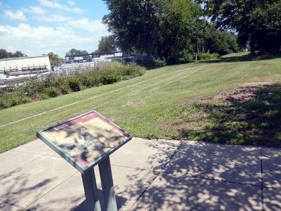
In front of this sign was Lock No. 2 of the Canal. The lock was outlined with edging and planted with flowers. A pathway is located where the earthen towpath used to be. On the other side of the lock was the Lock Shanty and Locktender’s House. It appears that a separate parcel for the House was never purchased by Lehigh Coal and Navigation Company, and so is not a part of the present state-owned Canal Park. Old photos indicated a fence along the Canal property in this area. A new fence, similar to the one formerly in place at Lock No. 2, screens views to the parking lot.
The Railroad itself faced hard times in the 20th century. The track bed located behind you near Pond Street, is now the Bristol Spurline Bike Trail.
Topics and series. This historical marker is listed in these topic lists: Industry & Commerce • Railroads & Streetcars • Waterways & Vessels
Location. This marker has been replaced by another marker nearby. It was located near 40° 5.858′ N, 74° 51.572′ W. Marker was in Bristol, Pennsylvania, in Bucks County. Marker was at the intersection of Pond Street and Bath Street on Pond Street. The marker is located in Canal Park. Touch for map. Marker was in this post office area: Bristol PA 19007, United States of America. Touch for directions.
Other nearby markers. At least 8 other markers are within walking distance of this location. Lock 2 (a few steps from this marker); Lock 3 (about 600 feet away, measured in a direct line); S/Sgt. James B. Boyle (about 600 feet away); The Firehouse (about 700 feet away); The Bend before the End (about 800 feet away); Abraham Lincoln (about 800 feet away); Lock 1 (approx. 0.2 miles away); The Locktender's House at Lock 1 (approx. 0.2 miles away). Touch for a list and map of all markers in Bristol.
Related marker. Click here for another marker that is related to this marker. This marker has been replaced by the linked marker.
Credits. This page was last revised on November 14, 2020. It was originally submitted on August 13, 2015, by Don Morfe of Baltimore, Maryland. This page has been viewed 317 times since then and 18 times this year. Photos: 1, 2. submitted on August 13, 2015, by Don Morfe of Baltimore, Maryland. • Bill Pfingsten was the editor who published this page.

