Volcano in Amador County, California — The American West (Pacific Coastal)
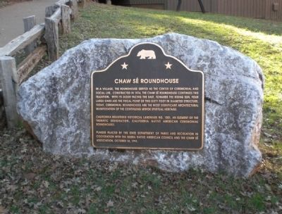
Chaw Sé Roundhouse
California Registered Historical Landmark No. 1001, an element of the thematic designation, California Native American Ceremonial Roundhouses.
Plaque placed by the State Department of Parks and Recreation in cooperation with the Sierra Native American Council and the Chaw Sé Association, October 14, 1974.
Erected 1994 by California State Department of Parks and Recreation. (Marker Number 1001.)
Topics and series. This historical marker is listed in these topic lists: Native Americans • Notable Buildings. In addition, it is included in the California Historical Landmarks series list. A significant historical date for this entry is October 14, 1974.
Location. 38° 25.489′ N, 120° 38.474′ W. Marker is in Volcano, California, in Amador County. Marker can be reached from Pine Grove Volcano Road. The marker is within Indian Grinding Rock State Historic Park, between the parking lot and the visitor center. Touch for map. Marker is in this post office area: Volcano CA 95689, United States of America. Touch for directions.
Other nearby markers. At least 8 other markers are within 2 miles of this marker, measured as the crow flies. Petroglyphs (Rock Carvings) (about 400 feet away, measured in a direct line); Chaw'se (about 400 feet away); Hun'ge (about 700 feet away); Pine Grove (approx. 1.2 miles away); Volcano Masonic Cave (approx. 1.2 miles away); Moose Milk (approx. 1.3 miles away); St. George Hotel (approx. 1.3 miles away); General Store (approx. 1.3 miles away). Touch for a list and map of all markers in Volcano.
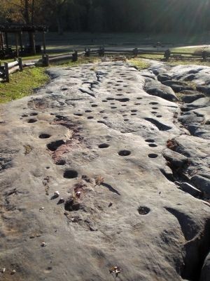
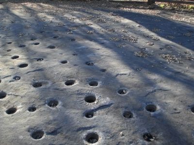
More about this marker. Indian Grinding Rock State Historic Park preserves 135 acres of meadows and Valley Oak lands. The highlight of the park is a large limestone outcropping, containing 1,185 mortar holes, as well as some petroglyphs. In addition to this grinding rock, the park also contains a roundhouse, a regional Native American museum, and reproductions of Native American bark houses.
Also see . . . The Rock and the People. The California Department of Parks and Recreation's web page for the grinding rock. (Submitted on June 30, 2008, by Andrew Ruppenstein of Lamorinda, California.)

Photographed By Andrew Ruppenstein, November 22, 2007
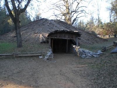
2. Chaw Se Roundhouse
The roundhouse is constructed of cedar poles secured with grapevine, and topped with cedar bark. Inside is a fire pit. The roof is supported oak pillars. A fire exit was added in the rear of the structure in 1993, per state fire regulations. The door faces the east to catch the sunrise.
The roundhouse is still used today, on occasion, for ceremonial dances.
Credits. This page was last revised on June 16, 2016. It was originally submitted on June 30, 2008, by Andrew Ruppenstein of Lamorinda, California. This page has been viewed 2,833 times since then and 27 times this year. Last updated on July 2, 2008, by Andrew Ruppenstein of Lamorinda, California. Photos: 1, 2, 3, 4. submitted on June 30, 2008, by Andrew Ruppenstein of Lamorinda, California. • Kevin W. was the editor who published this page.


