Near Mathiston in Choctaw County, Mississippi — The American South (East South Central)
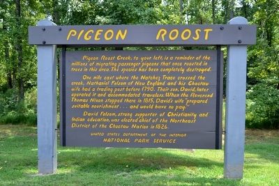
Pigeon Roost
One mile east where the Natchez Trace crossed the creek, Nathaniel Folsom of New England and his Choctaw wife had a trading post before 1790. Their son, David, later operated it and accommodated travelers. When the Reverend Thomas Nixon stopped there in 1815, David’s wife “prepared suitable nourishment ... and would have no pay.”
David Folsom, strong supporter of Christianity and Indian education, was elected chief of the Northeast District of the Choctaw Nation in 1826.
Erected by National Park Service.
Topics and series. This historical marker is listed in these topic lists: Animals • Industry & Commerce • Native Americans. In addition, it is included in the Natchez Trace series list. A significant historical year for this entry is 1790.
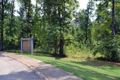
Location. 33° 31.899′ N, 89° 9.26′ W. Marker is near Mathiston, Mississippi, in Choctaw County. Marker is on Natchez Trace Parkway (at milepost 203.5), 0.6 miles south of U.S. 82, on the right when traveling north. Touch for map. Marker is in this post office area: Mathiston MS 39752, United States of America. Touch for directions.
Other nearby markers. At least 8 other markers are within 11 miles of this marker, measured as the crow flies. The Natchez Trace Parkway (approx. 0.8 miles away); Natchez Trace at Mathiston (approx. 1˝ miles away); Charles Lindbergh Landing Site (approx. 3.4 miles away); The Old Natchez Trace (approx. 4.9 miles away); Eupora (approx. 6.6 miles away); Webster County Courthouse (approx. 8.8 miles away); Line Creek (approx. 9.6 miles away); The Great Eastern Hardwood Forest (approx. 10.2 miles away). Touch for a list and map of all markers in Mathiston.
Also see . . .
1. Natchez Trace Parkway. Official National Park Service website. (Submitted on August 21, 2015.)
2. Pigeon Roost, Mississippi - Wikipedia entry. (Submitted on August 21, 2015.)
Credits. This page was last revised on June 16, 2016. It was originally submitted on August 21, 2015, by Duane Hall of Abilene, Texas. This page has been viewed 556 times since then and 30 times this year. Photos: 1, 2, 3. submitted on August 21, 2015, by Duane Hall of Abilene, Texas.


