Downtown Memphis in Shelby County, Tennessee — The American South (East South Central)
Mississippi River Park
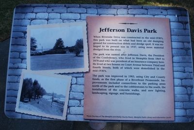
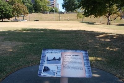
When Riverside Drive was constructed in the mid-1930's, this park was built on what had been an old dumping ground for construction debris and dredge soil. It was enlarged to its present size in 1937, using material dredged from the river.
The park is named after Jefferson Davis, the President of the Confederacy, who lived in Memphis from 1869 to 1878 and who was president of an insurance company here. He lived at two houses on Court Avenue between Third and Fourth Streets, both of which were demolished in the mid 1930's.
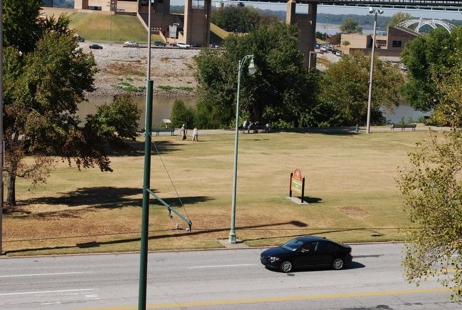
The park was improved in 1983, using City and County funds, as the first phase of a Riverfront Promenade. Improvements included connections to the parking areas north of the park and to the cobblestones to the south, the installation of the concrete walks, and new lighting, landscaping, signage, and furnishings.
Topics. This historical marker is listed in these topic lists: Government & Politics • War, US Civil. A significant historical year for this entry is 1937.
Location. 35° 8.834′ N, 90° 3.328′ W. Marker is in Memphis, Tennessee, in Shelby County. It is in Downtown Memphis. Marker can be reached from the intersection of Riverside Drive and Court Avenue, on the left when traveling north. Touch for map. Marker is in this post office area: Memphis TN 38103, United States of America. Touch for directions.
Other nearby markers. At least 8 other markers are within walking distance of this marker. Mud Island (a few steps from this marker); Fort Adams, Mississippi/Old River Control Structure/Homochitto Cutoff (within shouting distance of this marker); Cobblestone Landing (within shouting distance of this marker); The Sultana Disaster (about 300 feet away, measured in a direct line); Confederate Park (about 300 feet away); Naval Battle of Memphis, 1862 (about 400 feet away); Confederate History of Memphis (about 400 feet away); Memphis and Shelby County Medical Society (about 400 feet away). Touch for a list and map of all markers in Memphis.
Additional commentary.
1. Parks renamed by Memphis City Council.
Jefferson Davis Park has been renamed Mississippi River Park, Confederate Park has been renamed Memphis Park, and Forrest Park has been renamed Health Sciences Park. The name changes were quickly done, in 2013, just before the State of Tennessee passed a bill, the "Tennessee Heritage Protection Act of 2013" to prevent such name changes.
— Submitted April 6, 2018, by Mark Hilton of Montgomery, Alabama.
Credits. This page was last revised on February 7, 2023. It was originally submitted on September 7, 2015, by Brandon Fletcher of Chattanooga, Tennessee. This page has been viewed 457 times since then and 20 times this year. Photos: 1, 2, 3. submitted on September 7, 2015, by Brandon Fletcher of Chattanooga, Tennessee. • Bernard Fisher was the editor who published this page.


