Downtown Memphis in Shelby County, Tennessee — The American South (East South Central)
Mud Island
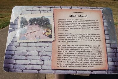
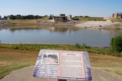
Mud Island, across the old Wolf River channel before you, began to be formed by the Mississippi River around 1900. By 1916 there was concern that it would grow so far south that it would block access to the harbor, so the island was connected to the mainland and the Wolf River was diverted to run between Mud Island and the mainland to keep the channel open.
In 1958, much of the western portion of the island was removed to make way for the new Hernando De Soto Bridge (Interstate Highway 40), and the Wolf River was cut through the north end of the island, creating the present slack-water harbor you see.
Mud Island River Park, directly in front of you, is owned by the City of Memphis and operated under the authority of the Riverfront Development Corporation. Construction began in 1977 and was completed in 1982 at the cost of $63 million. It celebrates the history and the culture of the Lower Mississippi River and contains a museum, an amphitheatre, shops, restaurants, play areas, canoe, kayak and bike rentals, and a scale model of the Mississippi River which runs the length of the park. Access is by a pedestrian bridge or monorail to your right. There is a second entrance on the north end just south of Auction Avenue.
Topics. This historical marker is listed in this topic list: Waterways & Vessels. A significant historical year for this entry is 1900.
Location. 35° 8.844′ N, 90° 3.33′ W. Marker is in Memphis, Tennessee, in Shelby County. It is in Downtown Memphis. Marker is on Riverside Drive. Touch for map. Marker is in this post office area: Memphis TN 38103, United States of America. Touch for directions.
Other nearby markers. At least 8 other markers are within walking distance of this marker. Fort Adams, Mississippi/Old River Control Structure/Homochitto Cutoff (a few steps from this marker); Mississippi River Park (a few steps from this marker); Cobblestone Landing (within shouting distance of this marker); The Sultana Disaster (within shouting distance of this marker); Confederate Park (about 400 feet away, measured in a direct line); Naval Battle of Memphis, 1862 (about 400 feet away); Confederate History of Memphis (about 500 feet away); Memphis and Shelby County Medical Society (about 500 feet away). Touch for a list and map of all markers in Memphis.
Credits. This page was last revised on February 7, 2023. It was originally submitted on September 7, 2015, by Brandon Fletcher of Chattanooga, Tennessee. This page has been viewed 516 times since then and 53 times this year. Photos: 1, 2, 3. submitted on September 7, 2015, by Brandon Fletcher of Chattanooga, Tennessee. • Bill Pfingsten was the editor who published this page.


