Cojutepeque, Cuscatlán, El Salvador — Central America (West Coast)
Expansion of El Salvador's Telephone System
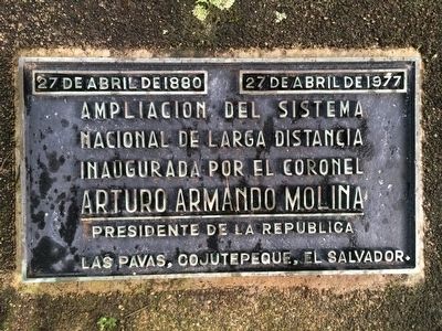
27 de abril de 1880 – 27 de abril de 1977
Ampliacion del sistema nacional de larga distancia
Inaugurada por el Colonel Arturo Armando Molina
Presidente de la Republica
Las Pavas, Cojutepeque, El Salvador.
April 27, 1880 – April 27, 1977
Expansion of the national long distance telephone system
Inaugurated by Colonel Arturo Armando Molina
President of the Republic
Las Pavas, Cojutepeque, El Salvador.
Erected 1977.
Topics. This historical marker is listed in these topic lists: Communications • Man-Made Features. A significant historical date for this entry is April 27, 1880.
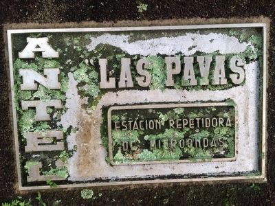
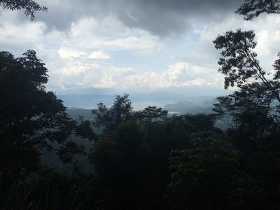
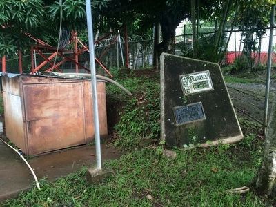
Location. 13° 42.786′ N, 88° 56.231′ W. Marker is in Cojutepeque, Cuscatlán. The marker is at the top of Cerro de la Pavas, inside of a fenced area protecting communications equipment. Touch for map. Marker is in this post office area: Cojutepeque, Cuscatlán 01401, El Salvador. Touch for directions.
Other nearby markers. At least 8 other markers are within 19 kilometers of this marker, measured as the crow flies. History of the Virgin of Fatima in Cerro de las Pavas (about 90 meters away, measured in a direct line); History of Cerro de las Pavas (about 90 meters away); Father Alirio Napoleón Macías (approx. 16.3 kilometers away); History of Ilobasco (approx. 16.8 kilometers away in Cabañas); Father Marino Braspenning (approx. 17.3 kilometers away in Cabañas); Apastepeque (approx. 17.7 kilometers away in San Vicente); Structure 1D1 or Southern Surveillance Point (approx. 19.1 kilometers away); Streets of Ciudad Vieja (approx. 19.2 kilometers away). Touch for a list and map of all markers in Cojutepeque.
Regarding Expansion of El Salvador's Telephone System. This marker commemorates a nationwide expansion of long-distance telephone service in El Salvador in 1977. Interestingly, the marker was dedicated on April 27, the same date in 1880 when the first telegraph service was installed in El Salvador. The first telegraph ran from San Salvador to the port at La Libertad and was useful for coffee traders and shippers. That first telegraph was installed by Charles H. Billings, an American engineer.
The marker is one of very few to mention ex-President Colonel Arturo Armando Molina. He was President from 1972 to 1977. The massacre
of students at the University of El Salvador happened during his term on July 30, 1975. Accusations of election fraud during the 1977 election, that supposedly helped Molina’s favored candidate Carlos Humberto Romero, led to further protests. After his presidency he fled the country and only returned in 1992 after the signing of the Peace Accords.
Photographed By J. Makali Bruton, September 19, 2015
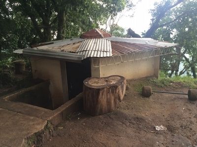
5. Soldiers' bunker on Cerro de las Pavas
Due to the hill's strategic importance and its communications equipment, a military base was located on Cerro de la Pavas during El Salvador's internal conflict. Local sources say as many as 1,000 troops were stationed on the hill during the peak of the war. This bunker, still in use by the few soldiers protecting the telephone equipment, is a remnant from that time.
Credits. This page was last revised on May 9, 2021. It was originally submitted on September 21, 2015, by J. Makali Bruton of Accra, Ghana. This page has been viewed 699 times since then and 23 times this year. Photos: 1, 2, 3, 4, 5. submitted on September 21, 2015, by J. Makali Bruton of Accra, Ghana.
