Marker Logo HMdb.org THE HISTORICAL
MARKER DATABASE
“Bite-Size Bits of Local, National, and Global History”
Hanson in Hopkins County, Kentucky — The American South (East South Central)
 

Partisan Rangers


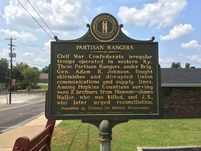
Partisan Rangers Marker image. Click for full size.
Photographed By Mark Hilton, September 1, 2015
1. Partisan Rangers Marker
Inscription. Civil War Confederate irregular troops operated in western Ky. These Partisan Rangers, under Brig. Gen. Adam R. Johnson, fought skirmishes and disrupted Union communications and supply lines. Among Hopkins Countians serving were 2 brothers from Hanson--James Waller, who was killed, and J.S., who later urged reconciliation.
Presented by Citizens for Historic Preservation

 
Erected 1996 by the Kentucky Historical Society Kentucky Department of Highways. (Marker Number 1971.)
 
Topics and series. This historical marker is listed in this topic list: War, US Civil. In addition, it is included in the Kentucky Historical Society series list.
 
Location. 37° 25.042′ N, 87° 28.921′ W. Marker is in Hanson, Kentucky, in Hopkins County. Marker is on Sunset Road (Kentucky Route 260) 0.1 miles west of Hanson Road (U.S. 41), on the right when traveling west. Touch for map. Marker is at or near this postal address: 50 Sunset Road, Hanson KY 42413, United States of America. Touch for directions.
 
Other nearby markers. At least 8 other markers are within 7 miles of this marker, measured as the crow flies. Hanson (about 300 feet away, measured in a direct line); Jackson Stage Stop (approx. 3.2 miles away); Forrest Reconnoitered (approx. 5.4 miles away); Rosenwald High School / Professor C. L. Timberlake
Paid Advertisement
Click on the ad for more information.
Please report objectionable advertising to the Editor.
Click or scan to see
this page online
(approx. 6 miles away); Harvey-Bassett House (approx. 6 miles away); Zion Temple A.M.E. Zion Church (approx. 6 miles away); Steuben's Lick (approx. 6.1 miles away); a different marker also named Steuben's Lick (approx. 6.1 miles away). Touch for a list and map of all markers in Hanson.
 
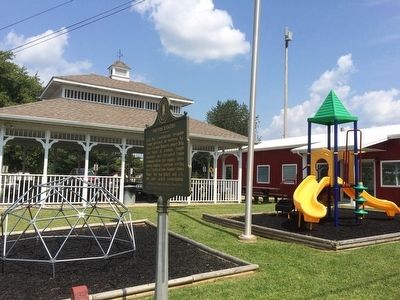
View of marker in front of city park. image. Click for full size.
Photographed By Mark Hilton, September 1, 2015
2. View of marker in front of city park.
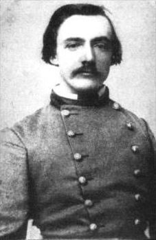
Adam Rankin "Stovepipe" Johnson image. Click for full size.
Public Domain
3. Adam Rankin "Stovepipe" Johnson
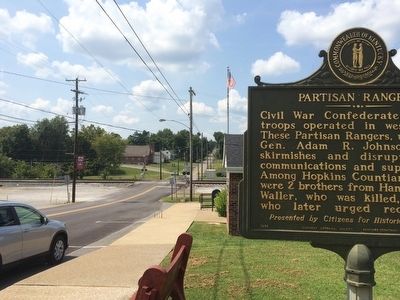
View from marker looking west on Sunset Road. image. Click for full size.
Photographed By Mark Hilton, September 1, 2015
4. View from marker looking west on Sunset Road.
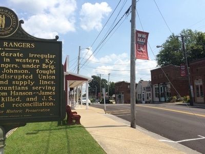
View of downtown Hanson. image. Click for full size.
Photographed By Mark Hilton, September 1, 2015
5. View of downtown Hanson.
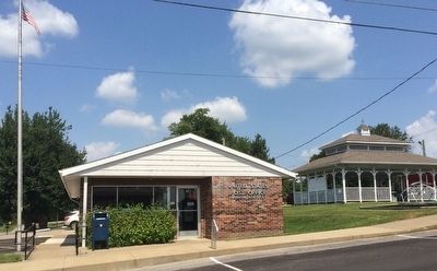
Post Office next to marker. image. Click for full size.
Photographed By Mark Hilton, September 1, 2015
6. Post Office next to marker.
 
 
Credits. This page was last revised on October 30, 2020. It was originally submitted on September 24, 2015, by Mark Hilton of Montgomery, Alabama. This page has been viewed 521 times since then and 28 times this year. Photos:   1, 2, 3, 4, 5, 6. submitted on September 24, 2015, by Mark Hilton of Montgomery, Alabama.
Share this page.  
Share on Tumblr
m=88957

CeraNet Cloud Computing sponsors the Historical Marker Database.
This website earns income from purchases you make after using our links to Amazon.com. We appreciate your support.
Paid Advertisement
Apr. 26, 2024