Woodstock in Shenandoah County, Virginia — The American South (Mid-Atlantic)
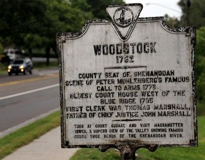
Woodstock
1752
Scene of Peter Muhlenburg's Famous
call to arms 1776
Oldest Court House west of the
Blue Ridge 1795
First Clerk was Thomas Marshall,
Father of Chief Justice John Marshall
———
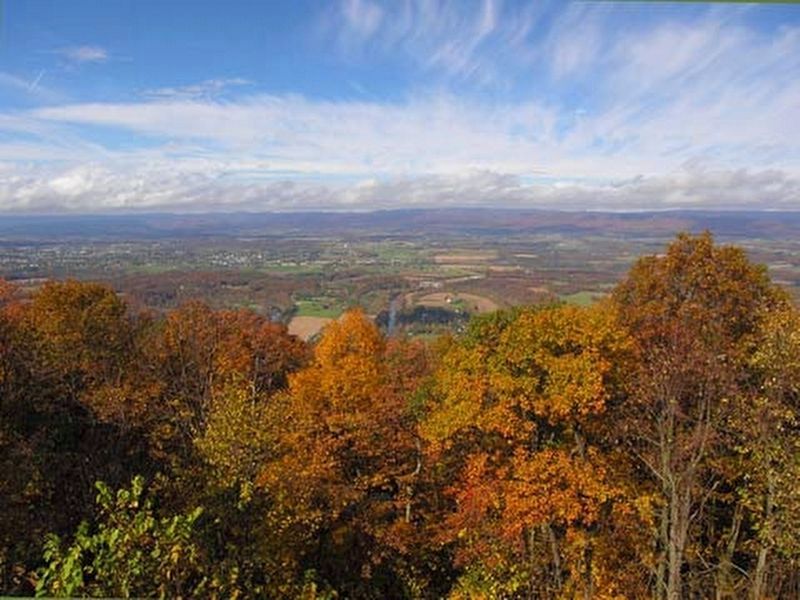
Turn at Court House square and visit Massanutten Tower, a superb view of the Valley showing famous horse shoe bends of the Shenandoah River.
Topics. This historical marker is listed in these topic lists: Natural Features • War, US Revolutionary. A significant historical year for this entry is 1776.
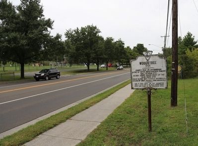
Location. 38° 52.371′ N, 78° 30.752′ W. Marker is in Woodstock, Virginia, in Shenandoah County. Marker is on South Main Street / Old Valley Pike (U.S. 11), on the right when traveling north. Touch for map. Marker is in this post office area: Woodstock VA 22664, United States of America. Touch for directions.
Other nearby markers. At least 8 other markers are within walking distance of this marker. Confederate Memorial (approx. ¼ mile away); Welcome to Woodstock's Lovework (approx. 0.4 miles away); Reformed Church in the United States (approx. half a mile away); Lieutenant Colonel A.S. "Sandie" Pendleton C.S.A. (approx. 0.7 miles away); Murphy House (approx. 0.7 miles away); Lest We Forget (approx. 0.7 miles away); Mount Jackson (approx. ¾ mile away); Toms Brook (approx. ¾ mile away). Touch for a list and map of all markers in Woodstock.
Regarding Woodstock. To get to the observation tower mentioned on the marker, turn right at Court Street, left at Water Street and right on Cemetery Road (County route 758). Carefully follow Route 758 at intersections. It will cross the Shenandoah River and climb Massanutten Mountain to the tower parking lot. The tower is a 10 minute walk from the parking lot with no significant elevation gain. (The road is closed in winter at its entrance to the George Washington National Forest.)
Related marker. Click here for another marker that is related to this marker. Another copy of this marker is also on Route 11 at the northern entrance to town.
Also see . . . Wikipedia entry for Woodstock. “In the late 1770s, John Muhlenberg was pastor at a Lutheran church located in the heart of Woodstock. As a famous story of Muhlenberg has it, at conclusion of his farewell sermon on January 21, 1776, Muhlenberg threw off his clerical robes to reveal an officer's uniform beneath and shouted, ‘there is a time to pray and a time to fight...’ With that declaration, the story says he then called for volunteers to join the 8th Virginia Regiment under his command.” (Submitted on October 3, 2015.)
Credits. This page was last revised on April 24, 2020. It was originally submitted on October 3, 2015, by J. J. Prats of Powell, Ohio. This page has been viewed 469 times since then and 27 times this year. Photos: 1, 2. submitted on October 3, 2015, by J. J. Prats of Powell, Ohio. 3. submitted on April 22, 2020, by Linda Walcroft of Woodstock, Virginia.


