Fort Bridger in Uinta County, Wyoming — The American West (Mountains)
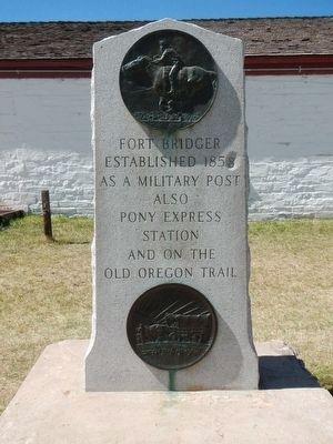
Fort Bridger
— Carter Military Road —
As a Military Post
Also
Pony Express
Station
An on the
Old Oregon Trail
Erected by Pony Express Trail Association.
Topics and series. This historical marker is listed in these topic lists: Communications • Roads & Vehicles • Settlements & Settlers. In addition, it is included in the Pony Express National Historic Trail series list.
Location. 41° 19.112′ N, 110° 23.379′ W. Marker is in Fort Bridger, Wyoming, in Uinta County. Marker can be reached from Business U.S. 80 near Main Street, on the left when traveling west. Touch for map. Marker is in this post office area: Fort Bridger WY 82933, United States of America. Touch for directions.
Other nearby markers. At least 8 other markers are within walking distance of this marker. The Post Trader's Store (a few steps from this marker); The Post Trader (a few steps from this marker); Ice House, Warehouse and Mess Hall (a few steps from this marker); School House, Milk House & Wash House (within shouting distance of this marker); The First School House in Wyoming (within shouting distance of this marker); Old Fort Bridger (within shouting distance of this marker); Post Trader’s House (within shouting distance of this marker); Carriage House, Stables and Chicken Coop (within shouting distance of this marker). Touch for a list and map of all markers in Fort Bridger.
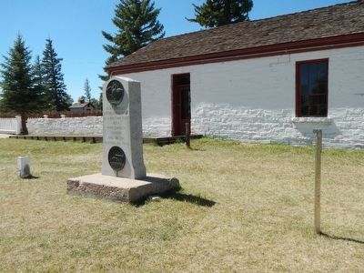
More about this marker. This marker is located on the grounds of Fort Bridger Historic Site. Obtain a map at the entrance or museum.
Also see . . . Carter Military Road - U.S. Department of Agriculture, Forest Service. Ashley Valley residents were concerned about their safety after Custer's defeat in 1876, and the recent fighting in western Colorado. In 1881, Fort Thornburgh was established at the mouth of Ashley Canyon, just northwest of Vernal. The army's mission was to keep the Utes on the reservation. The fort's location was uncomfortably remote... During the summer of 1881, General George Crook inspected the old Lodgepole Trail across the Uinta Mountains that had been used by the Uinta Utes. Crook approved this route over an alternate trail as the supply route to the garrison at Fort Thornburgh. (Submitted on November 17, 2015, by Barry Swackhamer of Brentwood, California.)
Credits. This page was last revised on June 16, 2016. It was originally submitted on November 17, 2015, by Barry Swackhamer of Brentwood, California. This page has been viewed 435 times since then and 29 times this year. Photos: 1, 2, 3, 4. submitted on November 17, 2015, by Barry Swackhamer of Brentwood, California.


