Pound Gap in Wise County, Virginia — The American South (Mid-Atlantic)
Pound Gap Engagement
Southwest Virginia Gateway
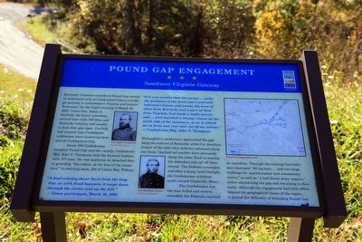
About 500 Confederates occupied Pound Gap and the vicinity. Confederate Maj. John P Thompson held the forward location with 175 men, the rest scattered on detached duty or guarding “the cabins, at the foot of the mountain.” In swirling snow, 100 of Union Maj. William McLaughlin’s cavalrymen approached the gap along the road out of Kentucky, while Col. Jonathan Cranor of the 40th Ohio Infantry advanced along one flank. Garfield led another force personally along the other flank to envelop the defenders and cut off their retreat. The Federals converged and after a sharp, brief firefight, the Confederates withdrew south toward Gladeville (Wise).
The Confederates lost one man killed and several wounded; the Federals reported no casualties. Through the evening Garfield's men destroyed “60 log huts and two large buildings for quartermaster and commissary stores,“ as well as “a half dozen army wagons,” before abandoning the gap and returning to Kentucky. Although the engagement had little effect beyond the geographical limits of the region, it proved the difficulty of defending Pound Gap.
“A loud echoing shout burst from the long line, as with fixed bayonets it swept down through the ravine and up the hill.” —Union participant, March 16, 1862
“It is now certain that the enemy, ... under the guidance of the most expert and well informed citizens and scouts, the most of them from Kentucky and a part of them from Virginia, had made a night march, and had marched a strong column on south side of the mountain, so as to attack me in front and rear and cut off my retreat.” —Confederate Maj. John P. Thompson
Erected by Virginia Civil War Trails.
Topics. This historical marker is listed in this topic list: War, US Civil. A significant historical date for this entry is March 16, 1862.
Location. 37° 9.318′ N, 82° 37.422′ W. Marker is in Pound Gap, Virginia, in Wise County. Marker is at the intersection of Orby Cantrell Highway (U.S. 23) and Potter Town Road (County Route 667), on the left when traveling north on Orby Cantrell Highway. Touch for map. Marker is in this post office area: Pound VA 24279, United States of America. Touch for directions.
Other nearby markers. At least 8 other markers are within walking distance of this marker. The Crooked Road (within shouting distance of this marker); Daniel Webster Dotson (within shouting distance of this marker); Pound Gap (approx. 0.4 miles away); Leonard Woods Lynched (approx. 0.4 miles away); Wise County / Kentucky (approx. half a mile away); Caudill’s Army (approx. half a mile away in Kentucky); Brothers Once More (approx. half a mile away in Kentucky); Pound Gap Massacre (approx. 0.6 miles away in Kentucky). Touch for a list and map of all markers in Pound Gap.
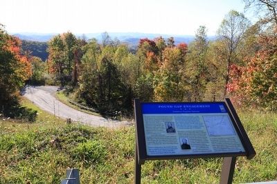
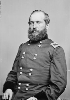
Regarding Pound Gap Engagement. On the left on the marker is a map titled “Pound Gap Engagement, 1862” and to the left two portraits, one of “Gen. James A. Garfield” and the other of “Col. Jonathan Cranor.”
Also see . . . The Battle at Pound Gap - March 16, 1862. 1982 article in Historical Sketches of Southwest Virginia. “Conceiving the rebels about to make a permanent stand, General Garfield drew up his line in front of them, with his right resting on the summit of the mountain, and the left stretched away down the eastern slope. About this time, the rebel line seemed to be melting away, as though they were gradually falling back into the woods. Fearing the results of a loss of time, General Garfield immediately ordered his men forward to scale the hill, and, if necessary, carry it at the point of the bayonet.” (Submitted on November 20, 2015.)
Credits. This page was last revised on June 16, 2016. It was originally submitted on November 20, 2015, by J. J. Prats of Powell, Ohio. This page has been viewed 893 times since then and 36 times this year. Photos: 1, 2, 3. submitted on November 20, 2015, by J. J. Prats of Powell, Ohio.


