Plymouth in Litchfield County, Connecticut — The American Northeast (New England)
First Congregational Church of Plymouth
Inscription.
First Congregational Church of Plymouth
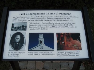
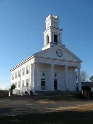
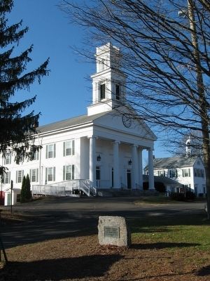
The First Congregational Church had its beginnings as the Ecclesiastical Society of Northbury, established in 1739. The first meetinghouse was completed during the 1760s. The second meetinghouse was built in the 1790s. The present day church was built in 1838.
This woodcut of Plymouth Center, looking westward from Main Street, shows the second meetinghouse on the left side of the Green, and St. Peter's Episcopal Church (built in 1796) on the far right, facing North Street.
Topics. This historical marker is listed in these topic lists: Churches & Religion • Colonial Era.
Location. 41° 40.339′ N, 73° 3.233′ W. Marker is in Plymouth, Connecticut, in Litchfield County. Marker is at the intersection of Park Street and Main Street (U.S. 6), on the right when traveling south on Park Street. Located next to the Plymouth Green. Touch for map. Marker is at or near this postal address: 10 Park Street, Plymouth CT 06782, United States of America. Touch for directions.
Other nearby markers. At least 8 other markers are within walking distance of this marker. Plymouth Soldiers Memorial (within shouting distance of this marker); Constitution Oak (within shouting distance of this marker); Plymouth Center School (within shouting distance of this marker); Plymouth Burying Ground (within shouting distance of this marker); Site Of St. Peter’s Church (about 300 feet away, measured in a direct line); Plymouth (approx. 0.6 miles away); Fr. Michael J. McGivney (approx. one mile away); Thomaston Veterans Monument (approx. one mile away). Touch for a list and map of all markers in Plymouth.
Credits. This page was last revised on June 16, 2016. It was originally submitted on November 21, 2015, by Michael Herrick of Southbury, Connecticut. This page has been viewed 354 times since then and 42 times this year. Photos: 1, 2, 3, 4. submitted on November 21, 2015, by Michael Herrick of Southbury, Connecticut.


