Near Montpelier in Bear Lake County, Idaho — The American West (Mountains)
Big Hill...
Inscription.
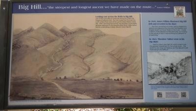
"the steepest and longest ascent we have made on the route..." - James Wilkins
Looking east across the fields is Big Hill, one of the most difficult obstacles along the 2,000-mile Oregon/California Trail. The trail crosses the Thomas Fork, north of Bear River and climbs up the steep Sheep Creek Hills. After reaching the summit, the pioneers could briefly glimpse westward to the beautiful Bear River Valley below before undertaking a steep descent down Big Hill.
In 1849, James Wilkins illustrated Big Hill (left) and recorded in his diary "... this morn we started at sunrise, being obliged (to) ascend and descend the mountain the steepest and longest ascent we have made on route. I made a sketch of the descent on the other side, but oweing (sic) to the clouds of dust, it was anything but pleasant to sit sketching."
In 1843, Theodore Talbot wrote in his trip diary: "....had to cross a very high hill, which is said to be the greatest impediment on the whole route.... The ascent is very long and tedious, but the descent is still more abrupt and difficult."
Erected by The National Oregon/California Trail Center.
Topics and series. This historical marker is listed in these topic lists: Roads & Vehicles • Settlements & Settlers. In addition, it is included in the Oregon Trail series list.
Location. 42° 14.152′ N, 111° 13.978′ W. Marker is near Montpelier, Idaho, in Bear Lake County. Marker is on U.S. 30 at milepost 441.7 near Hunters Lane, on the right when traveling west. Touch for map. Marker is in this post office area: Montpelier ID 83254, United States of America. Touch for directions.
Other nearby markers. At least 8 other markers are within 2 miles of this marker, measured as the crow flies. Hot, Cold, Dry, Wet, Dusty, 2,000-Mile Trail (here, next to this marker); Idaho's Emigrant Trails (here, next to this marker); Big Hill (here, next to this marker); One Continual Stream (here, next to this marker); a different marker also named Big Hill (a few steps from this marker); The McAuley Cutoff (a few steps from this marker); McAuley's Road (a few steps from this marker); Smith's Trading Post (approx. 1.7 miles away). Touch for a list and map of all markers in Montpelier.
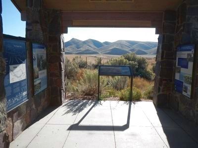
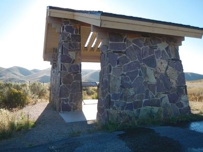
More about this marker. This marker is located in the stone kiosk.
Credits. This page was last revised on June 16, 2016. It was originally submitted on November 22, 2015, by Barry Swackhamer of Brentwood, California. This page has been viewed 602 times since then and 26 times this year. Photos: 1, 2, 3. submitted on November 22, 2015, by Barry Swackhamer of Brentwood, California.


