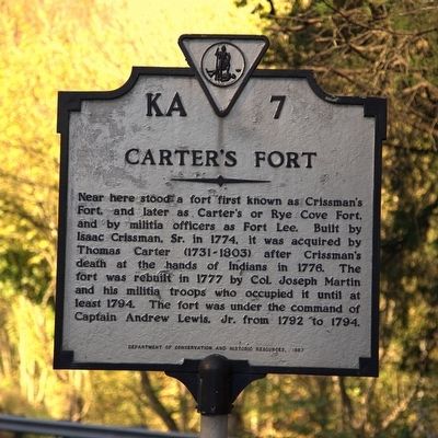
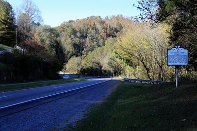
Near Glenita in Scott County, Virginia — The American South (Mid-Atlantic)
Carterís Fort
Erected 1987 by Department of Conservation and Historic Resources. (Marker Number KA-7.)
Topics and series. This historical marker is listed in these topic lists: Forts and Castles • Settlements & Settlers • Wars, US Indian. In addition, it is included in the Virginia Department of Historic Resources (DHR), and the Virginia, Clinch River Forts Circa 1774 series lists. A significant historical year for this entry is 1774.
Location. 36° 41.677′ N, 82° 45.207′ W. Marker is near Glenita, Virginia, in Scott County. Marker is on U.S. 58, 6.2 miles north of Natural Tunnel Parkway (County Route 871), on the right when traveling west. Touch for map. Marker is in this post office area: Duffield VA 24244, United States of America. Touch for directions.
Other nearby markers. At least 8 other markers are within 7 miles of this marker, measured as the crow flies. The Natural Tunnel Route (approx. 0.7 miles away); a different marker also named Carterís Fort (approx. 1.8 miles away); Speers Ferry (approx. 2.8 miles away); Natural Tunnel: Railroading and Recreation (approx. 2.8 miles away); The Copper Creek Railroad Trestles (approx. 2.8 miles away); The Wilderness Road Crossing of the Clinch River (approx. 2.8 miles away); Lee County / Scott County (approx. 5.8 miles away); Scott County / Lee County (approx. 6.9 miles away).
Also see . . . Frontier Forts of Southwest Virginia. 1968 article by Emory L. Hamilton. “Further westward in the Rye Cove of Scott County stood Carterís Fort, supposedly built by the Carter brothers, Joseph, Thomas and Norris. Most early historians place the date of this fort around 1786, but it can be proven by Revolutionary War pension claims that this date is at least a decade too late. James Elkins says in his pension statement filed in Clarke Co., KY in 1832, that he served at Carterís Station in the Rye Cove in the latter part of the summer of 1777, under Captain William Bowen. His statement is no doubt correct for Lieutenant William Bowen is shown to have been in the Rye Cove, both in 1776 and 1777, according to early military records. How many years prior to 1777 this fort existed is not known, but the Carter brothers were very early settlers in the Rye Cove with land entries in old Fincastle County in 1774. Since this was the most westward fort in Scott County and openly exposed to Indian forays it is reasonable to think that the early settlers of Rye Cove would have had a fort for their protection at a very early date. This was undoubtably a palisaded fort and it stood close along the old ĎHunterís Traceí passing through Scott County.” (Submitted on November 25, 2015.)
Credits. This page was last revised on October 26, 2023. It was originally submitted on November 24, 2015, by J. J. Prats of Powell, Ohio. This page has been viewed 1,428 times since then and 222 times this year. Photos: 1, 2. submitted on November 25, 2015, by J. J. Prats of Powell, Ohio.

