Near Lovell in Big Horn County, Wyoming — The American West (Mountains)
The Original Dayton-Kane Highway
US 14A
— (A National Scenic Byway) —
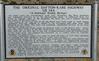
First access up the east side of the Big Horns were trails used to haul mining equipment from the railhead at Gillette to the Fortunatus gold mine, near Bald Mountain in the 1890s. The route was eventually abandoned because of its steep grades and sharp curves.
In 1912, construction began along an improved route on the Dayton side. About that same time, settlers in the Big Horn Basin carved out the beginnings of the first road on the west side to get salt to summer pastures, hence the road was known as the "Salt" road. The original was described as a wagon track of "extreme steepness and sharp turns."
In 1922, preliminary plans were made to build 148 miles of road from Sheridan to Greybull vial Bald Mountain, then to Lovell and Greybull.
Construction began on the east side and progressed westerly from Dayton, and 4.6 miles was completed in November 1924. A series of construction projects ensued until the road was mostly completed in the mid-1930s with a width from 10 to 24 feet, depending on topography.
Much of the road was privately financed. Funding and labor came variously from the timber industry, popular subscription and finally the Bureau of Public Roads and the Wyoming Highway Department. It was taken onto the state highway system in 1931 and eventually was asphalt paved by about 1939. For the next 25 years, only maintenance and occasional widening were accomplished on the road until reconstruction began in earnest in 1964.
Erected by Wyoming Transportation Department, Mary Alice Fortin Foundation of Florida and Big Horn Mountain Medicine Wheel Association.
Topics. This historical marker is listed in this topic list: Roads & Vehicles.
Location. 44° 47.871′ N, 107° 59.253′ W. Marker is near Lovell, Wyoming, in Big Horn County. Marker is at the intersection of U.S. 14A and Old U.S. Highway 14A, on the left when traveling east on U.S. 14A. Touch for map. Marker is in this post office area: Lovell WY 82431, United States of America. Touch for directions.
Other nearby markers. At least 8 other markers are within 8 miles of this marker, measured as the crow flies. Reconstruction - Finally! (approx. one mile away); Big Horn Basin (approx. 2.8 miles away); Bighorn Basin (approx. 2.8 miles away); Welcome to the Medicine Wheel (approx. 3.8 miles away); Five Springs (approx. 4 miles away); Medicine Wheel (approx. 4.6 miles away); a different marker also named Medicine Wheel (approx. 4.6 miles away); a different marker also named Medicine Wheel (approx. 7.2 miles away). Touch for a list and map of all markers in Lovell.
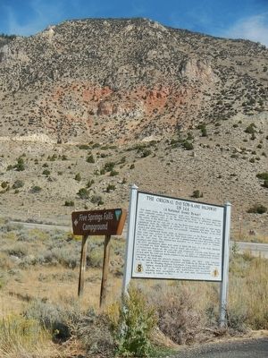
More about this marker. This marker is located at the turn-off for the Five Springs Campground.
Credits. This page was last revised on June 16, 2016. It was originally submitted on December 5, 2015, by Barry Swackhamer of Brentwood, California. This page has been viewed 1,173 times since then and 85 times this year. Photos: 1, 2. submitted on December 5, 2015, by Barry Swackhamer of Brentwood, California.

