Mills in Natrona County, Wyoming — The American West (Mountains)
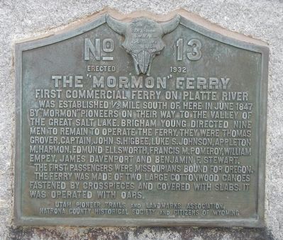
The “Mormon” Ferry
The first passengers were Missourians bound for Oregon. The ferry was made of two large cottonwood canoes fastened by cross pieces and covered with slabs. It was operated with oars.
Erected 1932 by Utah Pioneer Trails and Landmark Association, Natrona County Historical Society and Citizens of Wyoming. (Marker Number 13.)
Topics and series. This historical marker is listed in this topic list: Waterways & Vessels. In addition, it is included in the Utah Pioneer Trails and Landmarks Association series list.
Location. 42° 50.685′ N, 106° 22.504′ W. Marker is in Mills, Wyoming, in Natrona County. Marker is on 9th Street near Southwest Wyoming Boulevard, on the left. Touch for map. Marker is at or near this postal address: 699 9th Street, Mills WY 82644, United States of America. Touch for directions.
Other nearby markers. At least 8 other markers are within walking distance of this marker. The Town of Mills (a few steps from this marker); Oregon Trail (a few steps from this marker); Guinard Bridge (approx. half a mile away); Site of Old Platte Bridge (approx. half a mile away); The Upper Crossing (approx. half a mile away); The Road to Zion (approx. half a mile away); a different marker also named The Mormon Ferry (approx. half a mile away); Reconstructed Fort Caspar (approx. 0.6 miles away). Touch for a list and map of all markers in Mills.
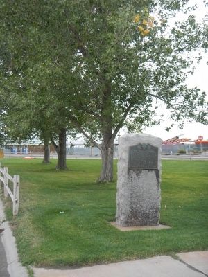
More about this marker. This marker is located in City Memorial Park, a triangular park in Mills bounded by Southwest Wyoming Boulevard, 9th Street and Platte Avenue.
Credits. This page was last revised on June 16, 2016. It was originally submitted on December 30, 2015, by Barry Swackhamer of Brentwood, California. This page has been viewed 502 times since then and 55 times this year. Photos: 1, 2. submitted on December 30, 2015, by Barry Swackhamer of Brentwood, California.

