Sioux City in Woodbury County, Iowa — The American Midwest (Upper Plains)
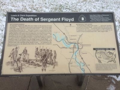
The Death of Sergeant Floyd
Lewis & Clark Expedition
On Monday, August 20, 1804 this was written in the journal of Lewis and Clark: "...I am Dull & heavy been up the greater Part of last night with Serjt. Floyd, who is as bad as he can be to live...We set out under a jentle Breeze from the S.E…. We came to make a warm bath for Sergt. Floyd hoping it would brace him a little, before we could get him into his bath he expired, with a great deel of composure, having Said to me before his death that he was going away and wished me to write a letter...We buried him to the top of a high round hill overlooking the river & Countrey for a great distance situated just below a small river without a name to which we name & call Floyds river, the Bluffs Sergts. Floyds Bluff ...we buried him with all the honors of War, and fixed a Ceeder post at his head with his name title and Day of the month & year...we returned to the Boat & proceeded to the Mouth of the little river 30 yd wide & camped a butifull evening."
Revisiting the Grave
On September 4, 1806, Clark wrote: "...and at the meridian we came too at Floyds Bluff...and ascended the hill, with Capt. Lewis and several men...we had the grave completely filed up and returned to the canoes & proceeded on to the sand bar on which we had encamped from 13th - 20th August 1804…"
Lewis & Clark 1803 - 1806
In 1803, President Thomas Jefferson sent an expedition commanded by Meriwether Lewis and William Clark to explore the newly acquired Louisiana Purchase, to seek an all-water route to the Pacific Ocean, and to make peaceable contact with the natives peoples. On may 14, 1804, the explorers headed up the Missouri. They reached the Pacific in November, 1805. They returned to St. Louis on September 23, 1806, having traveled more than 8000 miles in two years, four months and nine days.
Erected by Iowa Dept. of Natural Resources, National Park Service, State Historical Society of Iowa, REAP Historical Resource Grant, and the Sioux City Parks & Recreation.
Topics and series. This historical marker is listed in these topic lists: Cemeteries & Burial Sites • Exploration • Settlements & Settlers. In addition, it is included in the Former U.S. Presidents: #03 Thomas Jefferson, and the Lewis & Clark Expedition series lists. A significant historical date for this entry is May 14, 1804.
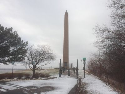
Location. 42° 27.757′ N, 96° 22.662′ W. Marker is in Sioux City, Iowa, in Woodbury County. Marker can be reached from S. Lewis Blvd., 0.3 miles north of Lincoln Way. Marker is located on the east side of the Floyd Monument at the base of the monument. Touch for map. Marker is in this post office area: Sioux City IA 51106, United States of America. Touch for directions.
Other nearby markers. At least 8 other markers are within 3 miles of this marker, measured as the crow flies. Sergeant Floyd Monument (a few steps from this marker); Sergeant Charles Floyd (a few steps from this marker); The Lewis & Clark Expedition (a few steps from this marker); Floyd Monument (a few steps from this marker); First Bride's Grave (approx. 0.3 miles away); Herbert Quick Ravine (approx. 0.4 miles away); MA1 (EXW) John Douangdara (approx. one mile away in Nebraska); Pacific Short Line Bridge (Nebraska Side) (approx. 2.4 miles away in Nebraska). Touch for a list and map of all markers in Sioux City.
Credits. This page was last revised on January 6, 2017. It was originally submitted on February 29, 2016, by Ruth VanSteenwyk of Aberdeen, South Dakota. This page has been viewed 473 times since then and 17 times this year. Photos: 1, 2. submitted on February 29, 2016, by Ruth VanSteenwyk of Aberdeen, South Dakota. • Bill Pfingsten was the editor who published this page.

