South Beach in San Francisco City and County, California — The American West (Pacific Coastal)
Building the Seawall
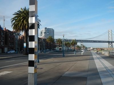
You are standing on section twelve of San Francisco's great seawall that was built between the years 1878 and 1924. Known as the Bulkhead, this continuous and massive embankment of stone was designed to hold back the bay, creating the curving line of the city front, first named East Street, and later The Embarcadero.
(map of the 1868 waterfront)
Earlier experiments with a seawall in 1868 had followed the grid line of the city streets on the north waterfront, but heavy silt deposits along the angular seawall were expensive to remove. The long curve of the new seawall cut across the old wharves, creating triangular waterfront lots, and required the construction of new piers that completely changed the configuration of San Francisco's City Front.
(Cross-section plan of the seawall)
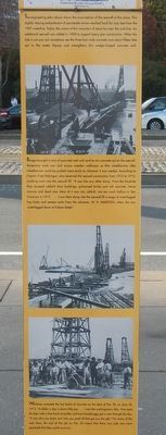
The engineering plan above shows the cross-section of the seawall at this place. This slightly slopping embankment of permeable stones reaches back for sixty feet from the 1907 waterline. Today, the crown of this mountain of stone lies near the curb-line. An additional seawall was added in 1908 to support heavy pier construction. When the tide is out you can sometimes see the three-foot wide concrete core about fifteen feet out in the water. Riprap rock strengthens this wedge-shaped concrete wall.
(photograph 4)
Barges brought in tons of quarried rock and sand to mix concrete out on the seawall. Temporary track was laid across wooden walkways so that wheelbarrow after wheelbarrow could be pushed more easily to wherever it was needed. According to Captain Fred Klebingat, who observed the seawall construction from 1910 to 1912, anything went into the seawall fill. "It was like any other dump. From the landslide they dumped rubbish from buildings, pulverized brick and old concrete. Horse manure and dead cats. Most of it was city rubbish, not too much ballast in San Francisco in 1912... I saw them dump into the seawall fill a cargo of waterlogged hay bales and cement sacks from the schooner, W.H. Marston, when she was waterlogged down at Folsom Street."
(photographs 5 and 6)
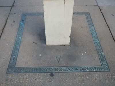
Workmen complete the last batch of concrete on the deck of Pier 32, on June 18, 1913. "A dollar a day is damn little pay..." went the workman's ditty. Five cents for beer with a free lunch of pickles and hard-boiled eggs got a man through the day. "It was who you knew and who you paid off that got you the job." For many of the men here, the end of the job on Pier 32 meant that there was only one more paycheck that they could count on.
Erected by San Francisco Art Commission for the Waterfront Transportation Projects.
Topics. This historical marker is listed in these topic lists: Charity & Public Work • Waterways & Vessels.
Location. 37° 46.975′ N, 122° 23.278′ W. Marker is in San Francisco, California, in San Francisco City and County. It is in South Beach. Marker is on The Embarcadero near Townsend Street. Touch for map. Marker is at or near this postal address: 675 The Embarcadero, San Francisco CA 94105, United States of America. Touch for directions.
Other nearby markers. At least 8 other markers are within walking distance of this marker. The Alaska Packers (within shouting distance of this marker); Remnants of Rincon Hill (within shouting distance of this marker); Fremont Street (about 300 feet away, measured in a direct line); The Oriental Warehouse (about 400 feet away); Townsend Street (about 500 feet away); Whaling Out of San Francisco (about 600 feet away); Java House (about 600 feet away); Brannan Street (about 700 feet away). Touch for a list and map of all markers in San Francisco.
More about this marker. This marker is on the San Francisco Bay Trail just north of Pier 38.
Credits. This page was last revised on February 7, 2023. It was originally submitted on March 10, 2016, by Barry Swackhamer of Brentwood, California. This page has been viewed 501 times since then and 23 times this year. Photos: 1, 2, 3, 4. submitted on March 10, 2016, by Barry Swackhamer of Brentwood, California.


