Norwich in Chenango County, New York — The American Northeast (Mid-Atlantic)
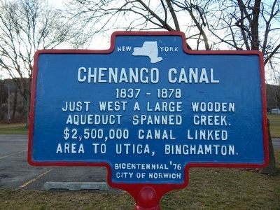
Chenango Canal
1837-1878
Erected 1976 by City of Norwich.
Topics and series. This historical marker is listed in these topic lists: Bridges & Viaducts • Waterways & Vessels. In addition, it is included in the Chenango Canal series list. A significant historical year for this entry is 1837.
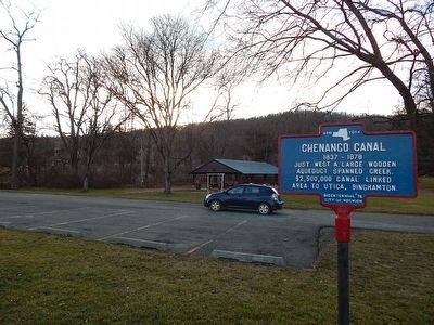
Location. 42° 31.208′ N, 75° 31.379′ W. Marker is in Norwich, New York, in Chenango County. Marker is on South Broad Street (New York State Route 12). Touch for map. Marker is in this post office area: Norwich NY 13815, United States of America. Touch for directions.
Other nearby markers. At least 8 other markers are within walking distance of this marker. A different marker also named Chenango Canal (approx. 0.6 miles away); Railroad Yards (approx. 0.6 miles away); Avery Power (approx. 0.7 miles away); Norwich World War I Memorial (approx. 0.8 miles away); Chenango County World War II Memorial (approx. 0.8 miles away); Purple Heart Community (approx. 0.8 miles away); Gateman’s Tower c. 1907 (approx. 0.8 miles away); Alert Hose Co. No. 1 (approx. 0.8 miles away). Touch for a list and map of all markers in Norwich.
Credits. This page was last revised on June 16, 2016. It was originally submitted on March 26, 2016, by Scott J. Payne of Deposit, New York. This page has been viewed 388 times since then and 21 times this year. Photos: 1, 2, 3, 4. submitted on March 26, 2016, by Scott J. Payne of Deposit, New York. • Bill Pfingsten was the editor who published this page.


