San Mateo in San Mateo County, California — The American West (Pacific Coastal)
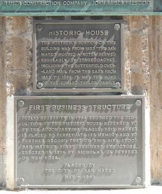
First Business Structure
Historic House
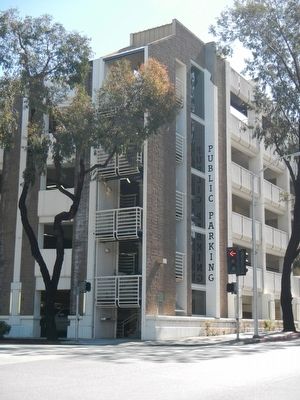
Public necessity in 1964 required the demolition of the historic house referred to by the accompanying plaque; this marker is placed to perpetuate its memory and to further record that on this site stood San Mateo's first business structure, erected in 1851 by Nicholas de Peyster of New York.
The northerly portion of this building was from 1853 "The San Mateo House," a hotel served regularly by stagecoaches, including the Butterfield Overland Mail from the East. From 1863 to 1899 it was the home of the Edward Taylor family.
Erected 1965 by The City of San Mateo.
Topics and series. This historical marker is listed in these topic lists: Industry & Commerce • Roads & Vehicles. In addition, it is included in the Butterfield Overland Mail series list.
Location. 37° 33.819′ N, 122° 19.594′ W. Marker is in San Mateo, California, in San Mateo County. Marker is at the intersection of South El Camino Real and 2nd Street, on the right when traveling north on South El Camino Real. Touch for map. Marker is at or near this postal address: 215 South El Camino Real, San Mateo CA 94401, United States of America. Touch for directions.
Other nearby markers. At least 8 other markers are within walking distance of this marker. Mission Hospice (about 800 feet away, measured in a direct line); Historic Camp Site (approx. 0.2 miles away); Higurashi-en (approx. ¼ mile away); Morse’s Corners (approx. ¼ mile away); Central Park Veterans Memorial (approx. 0.3 miles away); Central Park Veterans Memorial – World War I (approx. 0.3 miles away); Central Park Veterans Memorial - Screaming Eagles Grove (approx. 0.3 miles away); Central Park Veterans Memorial – Japanese American Combat Team (approx. 0.3 miles away). Touch for a list and map of all markers in San Mateo.
Credits. This page was last revised on June 16, 2016. It was originally submitted on March 26, 2016, by Barry Swackhamer of Brentwood, California. This page has been viewed 485 times since then and 18 times this year. Photos: 1, 2. submitted on March 26, 2016, by Barry Swackhamer of Brentwood, California.

