Near Spotsylvania Courthouse in Spotsylvania County, Virginia — The American South (Mid-Atlantic)
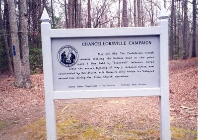
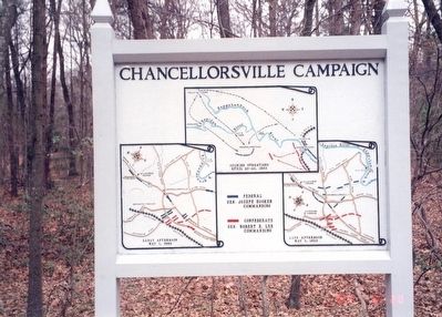
Chancellorsville Campaign
Erected by United States Department of the Interior, National Park Service.
Topics. This historical marker is listed in this topic list: War, US Civil. A significant historical date for this entry is May 3, 1863.
Location. 38° 18.712′ N, 77° 38.993′ W. Marker is near Spotsylvania Courthouse, Virginia, in Spotsylvania County. Marker can be reached from Bullock Road north of Plank Road (U.S. 3), on the right when traveling north. The marker is on the grounds of the Chancellorsville Visitor Center, Fredericksburg & Spotsylvania National Military Park. Touch for map. Marker is at or near this postal address: 9001 Plank Rd, Spotsylvania VA 22553, United States of America. Touch for directions.
Other nearby markers. At least 8 other markers are within walking distance of this marker. A different marker also named Chancellorsville Campaign (within shouting distance of this marker); Fredericksburg and Spotsylvania National Military Park (within shouting distance of this marker); Chancellorsville (within shouting distance of this marker); a different marker also named Chancellorsville Campaign (within shouting distance of this marker); The Battle of Chancellorsville (within shouting distance of this marker); a different marker also named Chancellorsville Campaign (about 300 feet away, measured in a direct line); Confederate Catastrophe (about 300 feet away); Civil War Earthworks (about 300 feet away). Touch for a list and map of all markers in Spotsylvania Courthouse.
Also see . . . Fredericksburg & Spotsylvania National Military Park. National Park Service (Submitted on April 4, 2016.)
Credits. This page was last revised on July 9, 2021. It was originally submitted on April 3, 2016, by Don Morfe of Baltimore, Maryland. This page has been viewed 340 times since then and 12 times this year. Photos: 1, 2. submitted on April 3, 2016, by Don Morfe of Baltimore, Maryland. • Bernard Fisher was the editor who published this page.

