Black Rock in Buffalo in Erie County, New York — The American Northeast (Mid-Atlantic)
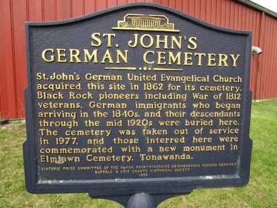
St. John's German Cemetery
acquired this site in 1862 for its cemetery.
Black Rock pioneers including War of 1812
veterans, German immigrants who began
arriving in the 1840s, and their descendants
through the mid 1920s were buried here.
The cemetery was taken out of service
in 1977, and those interred here were
commemorated with a new monument in
Elmlawn Cemetery, Tonawanda.
Erected 1999 by Historic Pride Committee of the Black Rock-Riverside Neighborhood Housing Services, Buffalo & Erie County Historical Society.
Topics. This historical marker is listed in these topic lists: Cemeteries & Burial Sites • War of 1812. A significant historical year for this entry is 1862.
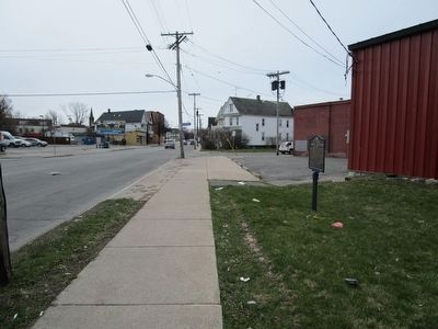
Location. Marker is missing. It was located near 42° 56.553′ N, 78° 53.514′ W. Marker was in Buffalo, New York, in Erie County. It was in Black Rock. Marker was at the intersection of Military Road (New York State Route 265) and Lansing Street, on the right when traveling south on Military Road. Located about 100 ft N of the intersection. Touch for map. Marker was in this post office area: Buffalo NY 14207, United States of America. Touch for directions.
Other nearby markers. At least 8 other markers are within walking distance of this location. Military Road (approx. 0.4 miles away); Battle of Scajaquada Creek Bridge (approx. 0.4 miles away); St. John's Church (approx. 0.6 miles away); Jacob Smith House and Tavern (approx. 0.7 miles away); Jubilee Springs (approx. 0.7 miles away); Stephen W. Howell (approx. 0.7 miles away); Buffalo and Niagara Falls Railroad (approx. 0.7 miles away); Black Rock Harbor (approx. ¾ mile away). Touch for a list and map of all markers in Buffalo.
More about this marker. The figure at the top of the marker is the Buffalo History Museum.
Additional commentary.
1. Current status of marker
It appears that the marker has been removed. A recent Google Earth location photo of this area from 2 months ago does not show the marker on what appears to be the property of a paint shop. Can this be confirmed? Also, were those interred at the old cemetery moved to another location?
Ed. Note: Sometime between May and Sept. of 2021, the marker went missing. A short piece of the mounting pole was still left in Sept. 2021, but was shown bent over in Feb. of 2022 and no longer visible by May, 2022.
— Submitted July 15, 2022, by Ken Wells of Jarrettsville, Maryland.
Credits. This page was last revised on February 16, 2023. It was originally submitted on April 10, 2016, by Anton Schwarzmueller of Wilson, New York. This page has been viewed 773 times since then and 32 times this year. Photos: 1, 2. submitted on April 10, 2016, by Anton Schwarzmueller of Wilson, New York.

