Florence in Lane County, Oregon — The American West (Northwest)
Florence: Industrial Beginnings
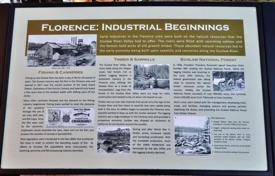
Early industries in the Florence area were built on the natural resources that the Siuslaw River Valley had to offer. The rivers were filled with swarming salmon and the forests held acres of old growth timber. Those abundant natural resources led to the early economy being built upon sawmills and canneries along the Siuslaw River.
Fishing & Canneries
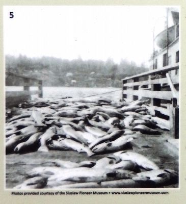
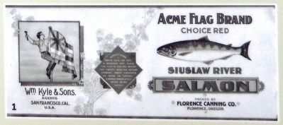
Fishing on the Siuslaw River has been a way of life for thousands of years. The Duncan Cannery was the first in the Florence area and opened in 1877 near the current location of the Coast Guard Station. Operations of the Duncan Cannery and Sawmill only lasted a few years due to the constant battle with shifting sand off the dunes.
Many other canneries followed and the demand on the fishing industry heightened. Fishing boats worked to meet the demands of the canneries through the use of set nets, drift nets, and fish traps. Once the fish were sold to the canneries, employees would assemble the cans, clean and cut the fish, and process the varieties of canned or barreled fish.
New regulations were introduced in the late 1890s that prohibited fish traps in order to protect the dwindling supply of fish. As efforts to increase fish populations were unsuccessful, the booming canneries and fish processing industry dwindled.
Timber & Sawmills
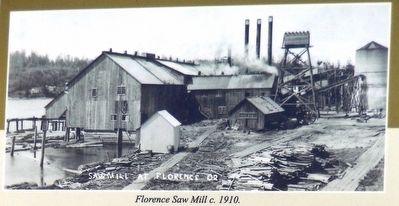
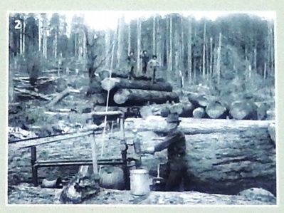
The Siuslaw River Valley, like many areas along the Oregon coast, had forests rich in timber. Logging became a prominent industry in the Florence area, utilizing the Siuslaw River as a mode of transportation. Logs from the forests in the Siuslaw River Valley were too large for cabin construction and needed to be cut down into boards to use.
Timber was cut near side channels that would carry the logs to the Siuslaw River and then down to sawmills that were rapidly being built in the area. As settlers began to populate the Florence area, sawmills worked to keep up with the lumber demand. The logging industry was a large employer in the Florence area and provided a prosperous economy. Lumber was shipped on schooners to California for distribution around the country.
During and after World War II, timber prices increased rapidly and harvesting accelerated. With the increased production, much of the viable timberland was harvested by the late 1950s and the logging industry declined.
Siuslaw National Forest
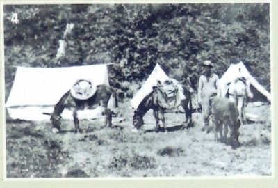
In 1908, President Theodore Roosevelt signed Executive Order Number 860 creating the Siuslaw National Forest. While the logging industry was booming in the early 20th Century, the federal government was taking steps to conserve the natural timber resources across the country. Initially, the Siuslaw National Forest
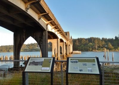
Photographed By Cosmos Mariner, July 3, 2015
2. Florence: Industrial Beginnings Marker
This marker (seen on the right side) is one of two markers under the Siuslaw River Bridge, overlooking the Siuslaw River as it flows through Florence into the Pacific Ocean. The other marker, (Siuslaw River Bridge: Construction & Design), can be seen on the left side.
Work crews were tasked with fire management; developing trails, roads, and facilities; managing pasture and grazing permits; stabilizing the dunes; and protecting the Siuslaw National Forest from timber thieves.
Topics and series. This historical marker is listed in these topic lists: Horticulture & Forestry • Industry & Commerce • Waterways & Vessels. In addition, it is included in the Former U.S. Presidents: #26 Theodore Roosevelt series list.
Location. 43° 57.972′ N, 124° 6.518′ W. Marker is in Florence, Oregon, in Lane County. Marker can be reached from Bay Street east of Kingwood Street. Marker is part of the Siuslaw River Bridge Interpretive Center, located under the referenced bridge, overlooking the Bridge and the Siuslaw River, at the edge of the parking lot behind the shops. Touch for map. Marker is at or near this postal address: 1220 Bay Street, Florence OR 97439, United States of America. Touch for directions.
Other nearby markers. At least 8 other markers are within 12 miles of this marker, measured as the crow flies. Siuslaw River Bridge: Construction & Design (here, next to this marker); Navigating the Siuslaw River (a few steps from this marker); Welcome to Historic Old Town (within shouting distance of this marker); Siuslaw River Bridge (about 300 feet away, measured in a direct line); Mapleton Depot (about 300 feet away); The Kyle Building (about 400 feet away); Harbor Theater (about 700 feet away); Technology Spans (approx. 11.6 miles away). Touch for a list and map of all markers in Florence.
Also see . . . History Of The Port.
In the early part of the 20th century, lumber and fisheries were the mainstays of the local economy in a relatively remote part of the State of Oregon. In March 1936, the McCullough designed bridge over the Siuslaw River was opened and became a part of Highway 101. (Submitted on April 14, 2016, by Cosmos Mariner of Cape Canaveral, Florida.)
Credits. This page was last revised on October 19, 2020. It was originally submitted on April 14, 2016, by Cosmos Mariner of Cape Canaveral, Florida. This page has been viewed 502 times since then and 40 times this year. Photos: 1, 2, 3, 4, 5, 6. submitted on April 14, 2016, by Cosmos Mariner of Cape Canaveral, Florida. 7, 8. submitted on April 23, 2016, by Cosmos Mariner of Cape Canaveral, Florida. • Syd Whittle was the editor who published this page.
