Green Acres in Palo Alto in Santa Clara County, California — The American West (Pacific Coastal)
Juana Briones. This is her park.
Inscription.
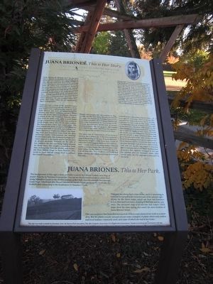
Juana Briones de Miranda lived not far from here at Rancho la Purísima Concepción. From her house on a knoll in the rolling foothills of Palo Alto, she could look down on the very land you’re standing on. Of course that would’ve been when she wasn’t busy working and managing her more than 4,000-acre rancho, and certainly not while caring for her large family and helping sick people who came to her. Juana Briones was a woman clearly forging a path well ahead of her era… a single parent in the 1800’s who achieved success as a businesswoman, property owner, and a curandero. She was a woman whose footprint, even today, makes her an extraordinary figure of inspiration.
California was a colony of the Spanish Empire when Juana was born in 1802 in Villa Branciforte, now Santa Cruz, California. Her parents came from Mexico and were of mixed European, African, and Native American ancestry. When Juana was 18, she married Apollinario Miranda, a soldier at the San Francisco Presidio, where they lived for many years. After a while Juana set up a second home in the area now known as North Beach, where she was the first resident. She farmed, had a dairy, and raised cattle. The ever-resourceful Juana prospered by selling her produce and milk to travelers, and trading cowhides (known as “California dollars”) for clothing, tools and household items from the ships anchored nearby. Unfortunately, her marriage became intolerable. Her husband no longer provided support to the family, and he had become an abusive alcoholic. Primarily for the sake of her children, she did something highly unusual for those times. She sought a separation from him, seeking help from the alcalde, and eventually from Bishop Diego in Santa Barbara, who wrote to local officials asking them to enforce the couple’s separation.
Women did not generally buy property in 1844, yet that was the year Juana Briones, purchased the 4,436-acre Rancho la Purísima Concepción from mission Indians. Jose Gorgonio and his son Ramon had been granted the land as part of the Mexican government’s distribution of former mission property. She was 42 years old, needed more land for her cattle, and seized the opportunity to expand her lucrative business for $300.
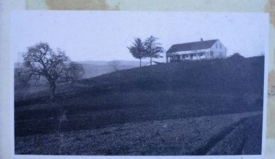
The exact year of construction of her house is unclear, but it shows up on the first surveyor’s map of about 1849 as “la casa de Juana Briones”. Her house, roughly a mile from here, is one of only a few remaining examples of this construction… a rare style of encasing earthen material inside a wooden frame. The site was given landmark status by the State of California and the City of Palo Alto. This is where you will still find Juana’s house, the oldest surviving structure in Palo Alto.
Juana Briones could neither read nor write… or even sign her own name. This is a woman who indicated her name with a cross. Yet, by the time California became a state in 1850, Juana owned a considerable amount if land, both here and in San Francisco. However, with statehood, the United States government required all landowners to verify legality of their claims. How did she do this, you ask? Remember that Juana had proved herself a savvy businesswoman, kept good records such as land survey, and was adept at choosing good people to represent her. Most Mexican rancho owners lost their land at this time. But Juana kept all of hers. She not only held onto her rancho, but waged a tenacious fight to maintain title to one of her San Francisco properties that rightfully belonged to her and the children after her husband’s death. After twelve years, the U.S. Supreme Court ruled in her favor.
Juana Briones. This is her park.
The background of this sign is most probably a survey by Chester Lyman circa 1849 of Juana’s Rancho la Purisima Concepción. You can see the current boundaries of her land: along Matadero Creek to the donkey pasture at Bol Park; then in a straight line through Gunn High School and Alta Mesa Cemetery to Adobe Creek; going up the creek into the foothills and connecting to the headwaters of Matadero Creek.
This
park has always been a train theme, and it is interesting to note that her property line included part of the railroad right-of-way for future trains, which ran from San Francisco to Los Altos and Los Gatos, stopping by Bol Park and the cemetery. The surveyor’s map is so accurate that today’s USGS maps show the same spring, and nearly the same location of Juana Briones’ house.
One cannot prove that Juana Briones used all of these exact plants in her work as a curandero. But the plants you see around you are some examples of plants which early settlers and local Indians commonly used, and some of which she had at her home.
Topics. This historical marker is listed in these topic lists: Agriculture • Industry & Commerce • Settlements & Settlers. A significant historical year for this entry is 1802.
Location. 37° 24.469′ N, 122° 7.644′ W. Marker is in Palo Alto, California, in Santa Clara County. It is in Green Acres. Marker can be reached from Maybell Avenue, 0.1 miles Clemo Avenue, on the right when traveling west. The marker is located near the northeast corner of the park behind the train play structure. Touch for map. Marker is at or near this postal address: 609 Maybell Avenue, Palo Alto CA 94306, United States of America. Touch for directions.
Other nearby markers. At least 8 other markers are within 2 miles of this marker, measured as the crow flies. Juana Briones Park (here, next to this marker); Mayfield Fire Bell (about 500 feet away, measured in a direct line); Homesite of Sarah Wallis (approx. 0.6 miles away); Birthplace of Silicon Valley (approx. 0.9 miles away); El Palo Nuevo (approx. 1.1 miles away); J. Pearce Mitchell Park (approx. 1.2 miles away); Site of Juana Briones de Miranda Home on Rancho La Purisima Concepcion (approx. 1.3 miles away); Play Ball! (approx. 1.4 miles away). Touch for a list and map of all markers in Palo Alto.
Also see . . . Juana Briones. The National Park Service - The Presidio Brochure gives a short description of Juana Briones and her life in the Bay Area. (Submitted on May 7, 2016.)
Additional keywords. Juana Briones. This is her park.
Credits. This page was last revised on February 7, 2023. It was originally submitted on May 7, 2016, by Syd Whittle of Mesa, Arizona. This page has been viewed 450 times since then and 33 times this year. Photos: 1, 2, 3. submitted on May 7, 2016, by Syd Whittle of Mesa, Arizona.


