Near Holladay in Benton County, Tennessee — The American South (East South Central)
Fort Johnson
Controlling the Tennessee River
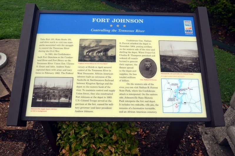
Take Exit 133, State Route 191, and drive north to visit two state parks associated with the struggle to control the Tennessee River during the Civil War.
In 1861, the Confederates built Fort Donelson on the Cumberland River and Fort Henry on the Tennessee River. Union Gen. Ulysses S. Grant and Adm. Andrew Foote captured them with army and navy forces in February 1862. The Federal victory at Shiloh in April secured control of the Tennessee River in West Tennessee. African American laborers built an extension of the Nashville & Northwestern Railroad between Kingston Springs and the depot on the eastern bank of the river. To maintain control and supply Union forces, they also constructed Fort Johnson at the depot in 1863. U.S. Colored Troops served as the garrison at the fort, named for military governor (and later president) Andrew Johnson.
Confederate Gen. Nathan B. Forrest attacked the depot in November 1864, posting artillery on the western side of the river and shelling the depot. When Union Col. Charles R. Thompson panicked and ordered all vessels burned to prevent their capture, the flames spread to the depot and supplies; the loss totaled millions of dollars.
On the western side of the river, you can visit Nathan B. Forrest State Park, where the Confederate attack is interpreted. On the eastern side, Johnsonville State Historic Park interprets the fort and depot. It includes two redoubts, rifle pits, the remains of a locomotive turntable, and an African American cemetery.
Erected by Tennessee Civil War Trails.
Topics and series. This historical marker is listed in these topic lists: African Americans • War, US Civil. In addition, it is included in the Former U.S. Presidents: #17 Andrew Johnson, and the Tennessee Civil War Trails series lists. A significant historical month for this entry is November 1864.
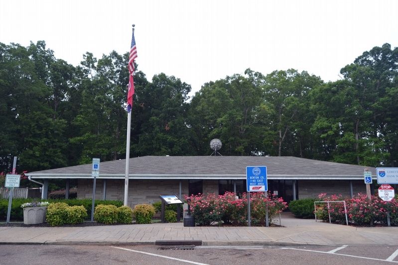
Location. 35° 52.208′ N, 88° 1.292′ W. Marker is near Holladay, Tennessee, in Benton County. Marker can be reached from Interstate 40 at milepost 130, on the right when traveling east. Marker is located at the Benton County I-40 East Rest Area; it is accessible only from the eastbound travel lanes of the freeway. Touch for map. Marker is in this post office area: Holladay TN 38341, United States of America. Touch for directions.
Other nearby markers. At least 8 other markers are within 13 miles of this marker, measured as the crow flies. Parker's Crossroads (approx. one mile away); Fighting on the Tennessee River (approx. 7.1 miles away); Captain William Robert Anderson (approx. 9.7 miles away); Hattie Wyatt Caraway (approx. 9.7 miles away); Jesse James (approx. 10.6 miles away); Pisgah United Methodist Church (approx. 11.4 miles away); Battle of Johnsonville (approx. 11.9 miles away); James Dickson House (approx. 13 miles away).
More about this marker. The marker also includes a photograph of the Johnsonville supply depot with Fort Johnson on a hill in the background; an image of a painting titled "Capture of Fort Henry by U.S. Gun Boats"; a portrait of Gen. Nathan B. Forrest; a photograph of the Johnsonville railyard; and a map of the location of the marker and Civil War sites in the area.
Credits. This page was last revised on August 2, 2020. It was originally submitted on August 9, 2016, by Duane Hall of Abilene, Texas. This page has been viewed 659 times since then and 32 times this year. Photos: 1, 2. submitted on August 9, 2016, by Duane Hall of Abilene, Texas.

