Georgetown in Northwest Washington in Washington, District of Columbia — The American Northeast (Mid-Atlantic)
Georgetown and the Chesapeake & Ohio Canal
Inscription.
Left panel:
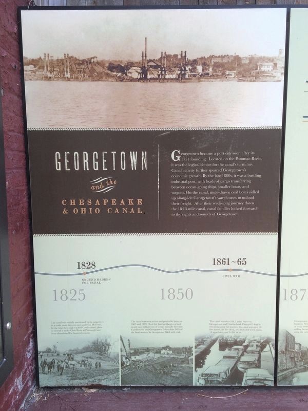
Georgetown became a port city soon after its 1751 founding. Located on the Potomac River, it was the logical choice for the canal’s terminus. Canal activity further spurred Georgetown’s economic growth. By the late 1800s, it was a bustling industrial port, with loads of cargo transferring between ocean-going ships, smaller boats, and wagons. On the canal, mule-drawn coal boats sidled up alongside Georgetown’s warehouses to unload their freight. After their week-long journey down the 184.5 mile canal, canal families looked forward to the sights and sounds of Georgetown.
Captions:
The canal was initially envisioned by its supporters as a trade route between east and west. However, by the time the canal reached Cumberland, plans to extend it to the Ohio River at Pittsburgh had been abandoned for financial reasons.
The canal was most active and profitable between 1865 and 1880. Over five hundred boats carried nearly one million tons of cargo annually between Cumberland and Georgetown. More than 90% of the boats arrived in Georgetown filled with coal.
The canal stretches 184.5 miles between Georgetown and Cumberland. Rising 605 feet in elevation along the journey, the canal averaged 60 feet across, six feet deep, and included seven dams, 11 aqueducts, and 74 lift locks.
Middle panel:
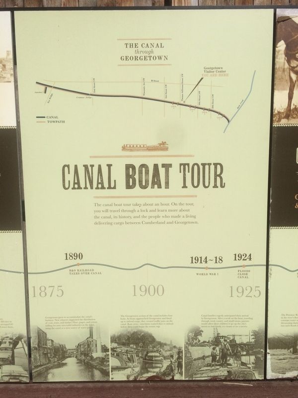
The Canal through Georgetown
Map of the canal and towpath
Canal Boat Tour
The canal boat tour takes about an hour. On the tour, you will travel through a lock and learn more about the canal, its history, and the people who made a living delivering cargo between Cumberland and Georgetown.
Captions:
Georgetown grew to accommodate the canal’s business. New wharves supported the distribution of coal, stone, and timber. Flour, paper, and cotton milling became successful industries in the town, using the canal as a new source of water power.
The Georgetown section of the canal includes four locks. As boats approached Georgetown and lined up to unload cargo, they created traffic jams on the canal. Boat crews sometimes waited days to unload before they could begin the return trip.
Canal families eagerly anticipated their arrival in Georgetown. After a week on the boat, traveling through rural country and small towns, parents would allow their children to go up to the city’s streets to buy candy, ice cream or see a movie.
Right panel:
Construction and Operation of the Chesapeake & Ohio Canal
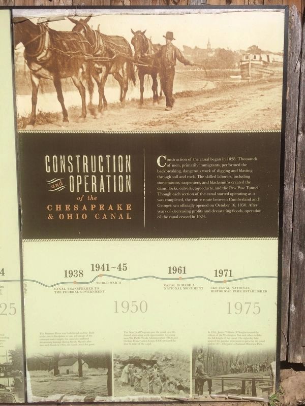
Construction of the canal began in 1828. Thousands of men, primarily immigrants, performed the backbreaking, dangerous work of digging and blasting through soil and rock. The skilled laborers,
including stonemasons, carpenters, and blacksmiths created the dams, locks, culverts, aqueducts, and the Paw Paw Tunnel. Though each section of the canal started operating as it was completed, the entire route between Cumberland and Georgetown officially opened on October 10, 1850. After years of decreasing profits and devastating floods, operation of the canal ceased in 1924.
Captions:
The Potomac River was both friend and foe. Built in the river's floodplain to take advantage of the constant water supply, the canal also suffered devastating damage during floods. Shortly after two such floods in 1924, the canals closed for good.
The New Deal Program gave the canal new life. Aimed at creating work opportunities for young men, the Public Works Administration (PWA) and Civilian Conservation Corps (CCC) restored the first 22 miles of the canal.
In 1954, Justice William O'Douglas invited the editors of the Washington Post and others to hike the full length of the canal. The eight-day hike spurred the popular movement to preserve the canal and in 1971, it became a National Historic Park.
Topics and series. This historical marker is listed in these topic lists: Bridges & Viaducts • Industry & Commerce • Settlements & Settlers
• Waterways & Vessels. In addition, it is included in the Chesapeake and Ohio (C&O) Canal series list. A significant historical year for this entry is 1751.
Location. 38° 54.26′ N, 77° 3.592′ W. Marker is in Northwest Washington in Washington, District of Columbia. It is in Georgetown. Marker can be reached from C&O Canal Towpath Northwest east of Thomas Jefferson Street Northwest, on the left when traveling east. Touch for map. Marker is at or near this postal address: 1057 Thomas Jefferson Street Northwest, Washington DC 20007, United States of America. Touch for directions.
Other nearby markers. At least 8 other markers are within walking distance of this marker. At All Hours (within shouting distance of this marker); William O. Douglas (within shouting distance of this marker); Mule Power (within shouting distance of this marker); Creating a National Park (within shouting distance of this marker); Georgetown Historic District (within shouting distance of this marker); The Duvall Foundry (within shouting distance of this marker); M Street - A Road Well Traveled (about 300 feet away, measured in a direct line); The Georgetown House (about 300 feet away). Touch for a list and map of all markers in Northwest Washington.
Photographed By Devry Becker Jones (CC0), March 29, 2020
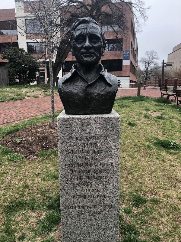
5. Nearby statue
Justice
William O. Douglas
for his
contributions toward
the establishment
of the Chesapeake
and Ohio Canal
National
Historical Park
National Park Service
May 17, 1977
Credits. This page was last revised on January 30, 2023. It was originally submitted on September 13, 2016, by J. Makali Bruton of Accra, Ghana. This page has been viewed 531 times since then and 27 times this year. Photos: 1, 2. submitted on September 13, 2016, by J. Makali Bruton of Accra, Ghana. 3. submitted on October 16, 2016, by J. Makali Bruton of Accra, Ghana. 4. submitted on September 15, 2016, by J. Makali Bruton of Accra, Ghana. 5. submitted on March 29, 2020, by Devry Becker Jones of Washington, District of Columbia. • Bill Pfingsten was the editor who published this page.
