Near Sharpsburg in Washington County, Maryland — The American Northeast (Mid-Atlantic)
We Poured Volley After Volley, Doubtless With Terrible Execution
Inscription.
Pvt. Berry Benson, 1st South Carolina Infantry, Gregg's Brigade
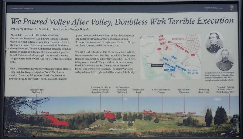
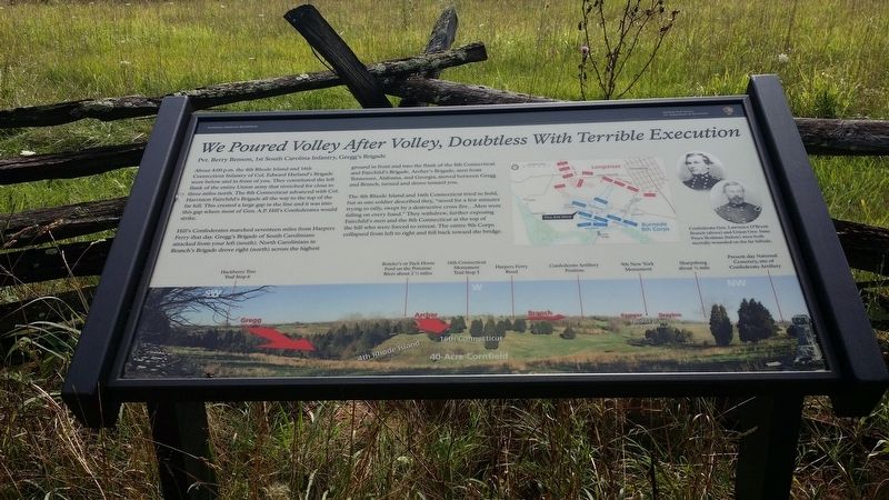
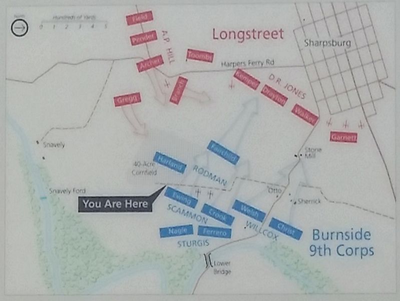
About 4:00 p.m. the 4th Rhode Island and 16th Connecticut Infantry of Col. Edward Harland's Brigade were below and in front of you. They constituted the left flank of the entire Union army that stretched for close to three miles north. The 8th Connecticut advanced with Col. Harrision Fairchild's Brigade all the way to the top of the far hill. This created a large gap in the line and it was into this gap where most of Gen. A. P. Hill's Confederates would strike.
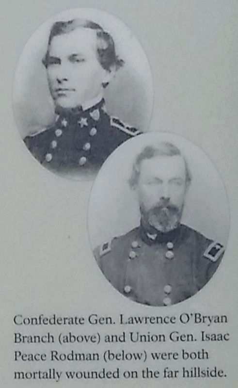
Hill's Confederates marched seventeen miles from Harpers Ferry that day. Gregg's Brigade of South Carolinians attacked from your left (south). North Carolinians in Branch 's Brigade drove right (north) across the highest ground in front and into the flank of the 8th Connecticut and Fairchild's Brigade. Archer's Brigade, men from Tennessee, Alabama, and Georgia, moved between Gregg and Branch, turned and drove toward you.
The 4th Rhode Island and 16th Connecticut tried to hold, but as one soldier described they, "stood for a few minutes trying to rally, swept by a destructive cross fire...Men were falling on every hand." They withdrew, further exposing Fairchild's men and the 8th Connecticut at the top of the hill who were forced to retreat. The entire 9th Corps collapsed from left to right and fell back toward the bridge.
Erected by Antietam National Battlefield - National Park Service - U.S. Department of the Interior.
Topics. This historical marker is listed in this topic list: War, US Civil. A significant historical year for this entry is 1862.
Location. 39° 26.884′ N, 77° 44.241′ W. Marker is near Sharpsburg, Maryland, in Washington County. Marker can be reached from Old Burnside Bridge Road. Located at stop seven of the Final Attack walking trail. Touch for map. Marker is in this post office area: Sharpsburg MD 21782, United States of America. Touch for directions.
Other nearby markers. At least 8 other markers are within walking distance of this marker. 12th Ohio Volunteer Infantry (within shouting distance of this marker); 16th Connecticut Volunteer Infantry (about 600 feet away, measured in a direct line); Battery E, 4th U.S. Artillery (about 600 feet away); 30th Ohio Volunteer Infantry (approx. 0.2 miles away); Ninth Army Corps (approx. 0.2 miles away); Archer's Brigade (approx. 0.2 miles away); Rodman's Division, Ninth Army Corps (approx. 0.2 miles away); a different marker also named Ninth Army Corps (approx. 0.2 miles away). Touch for a list and map of all markers in Sharpsburg.
Credits. This page was last revised on May 21, 2021. It was originally submitted on November 17, 2016, by Michael C. Wilcox of Winston-Salem, North Carolina. This page has been viewed 386 times since then and 14 times this year. Photos: 1, 2, 3, 4, 5. submitted on November 17, 2016, by Michael C. Wilcox of Winston-Salem, North Carolina.


