Orange in New Haven County, Connecticut — The American Northeast (New England)
Orange
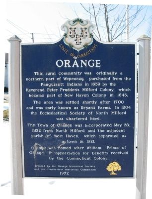
This rural community was originally a northern part of Wepawaug, purchased from the Paugussett Indians in 1639 by the Reverend Peter Prudden's Milford Colony, which became part of New Haven Colony in 1643.
The area was settled shortly after 1700 and was early known as Bryan's Farms. In 1804 the Ecclesiastical Society of North Milford was chartered here.
The Town of Orange was incorporated May 28, 1822 from North Milford and the adjacent parish of West Haven, which separated as a town in 1921.
Orange was named after William, Prince of Orange, in appreciation for benefits received by the Connecticut Colony.
Erected 1972 by Orange Historical Society, Connecticut Historical Commission.
Topics. This historical marker is listed in these topic lists: Colonial Era • Settlements & Settlers. A significant historical date for this entry is May 28, 1970.
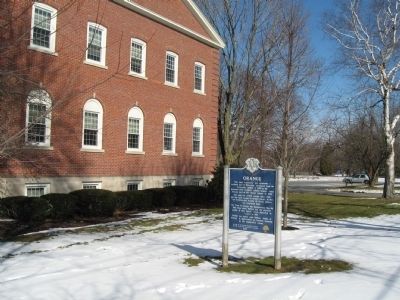
Location. 41° 16.734′ N, 73° 1.541′ W. Marker is in Orange, Connecticut, in New Haven County. Marker is at the intersection of Tyler City Road and Orange Center Road, on the right when traveling south on Tyler City Road. Located next to Orange Town Hall. Touch for map. Marker is at or near this postal address: 617 Orange Center Road, Orange CT 06477, United States of America. Touch for directions.
Other nearby markers. At least 8 other markers are within 4 miles of this marker, measured as the crow flies. Orange Veterans Monument (about 600 feet away, measured in a direct line); Sacred to the Memory (about 600 feet away); Adjutant William Campbell (approx. 3.4 miles away); A Connecticut Minuteman’s Homestead (approx. 3.7 miles away); Allingtown World War I Monument (approx. 3.7 miles away); VFW Post 1684 Memorial (approx. 3.7 miles away); Soldiers’ and Sailors’ Monument (approx. 3.7 miles away); West Haven Twilight League 1933 (approx. 3.7 miles away). Touch for a list and map of all markers in Orange.
Credits. This page was last revised on March 3, 2022. It was originally submitted on February 19, 2010, by Michael Herrick of Southbury, Connecticut. This page has been viewed 1,089 times since then and 25 times this year. Photos: 1, 2. submitted on February 19, 2010, by Michael Herrick of Southbury, Connecticut.

