Near Belington in Barbour County, West Virginia — The American South (Appalachia)
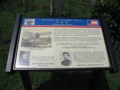
Battle of Laurel Hill
Tempest on the Turnpike
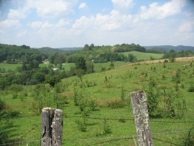
Union and Confederate forces clashed along the Beverly-Fairmont Turnpike (the narrow paved road in the foreground) on July 7-11, 1861. Union General Morris was ordered to "amuse" General Garnett at Laurel Hill - to make him believe the main attack would come here. Meanwhile, Major General George McClellan flanked the Confederates 20 miles south at Rich Mountain.
Spirited skirmishing took place among these hills. Union General Morris found it hard to restrain his troops. The Confederates fought with equal enthusiasm. Many deeds of bravery were witnessed here - the baptism of fire for both armies.
"The whistling of musket balls and the peculiar note of the Minnie projectiles as they rush madly past on their errand of death is a frightful sound to the recruit who for the first time hears it."
Col. William B. Taliaferro, 23rd Virginia Infantry C.S.A.
"I can say with truth that when called out to meet the enemy I am perfectly cool and deliberate."
John B. Pendleton, 23rd Virginia Infantry C.S.A.
"A few dozen of us, who had been swapping shots with the enemies' skirmishers, grew tired of the resultless battle, and by a common impulse - and I think without orders or officers - ran forward into the woods and attacked the Confederate works. We did well enough considering the hopeless folly of the movement, but we came out of the woods faster than we went in - a good deal."
Ambrose Bierce, 9th Indiana Infantry U.S.A.
Erected by West Virginia Civil War Trails.
Topics and series. This historical marker is listed in this topic list: War, US Civil. In addition, it is included in the Battlefield Trails - Civil War, and the West Virginia Civil War Trails series lists. A significant historical month for this entry is July 1774.
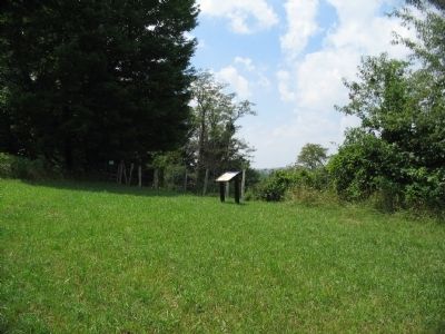
Location. 39° 0.535′ N, 79° 54.844′ W. Marker is near Belington, West Virginia, in Barbour County. Marker can be reached from Laurel Mountain Road (County Route 15), on the right when traveling east. Located in Laurel Hill Camp beside the Mill Creek Reservoir. Touch for map. Marker is in this post office area: Belington WV 26250, United States of America. Touch for directions.
Other nearby markers. At least 8 other markers are within walking distance of this marker. Cannons (about 500 feet away, measured in a direct line); Laurel Hill (about 700 feet away); Confederate Cemetery (about 700 feet away); Civil War (approx. 0.2 miles away); Forced Flight (approx. 0.2 miles away); Camp Laurel Hill (approx. ¼ mile away); Welcome to Camp Laurel Hill (approx. ¼ mile away); Laurel Hill Battlefield Veterans Memorial (approx. 0.3 miles away). Touch for a list and map of all markers in Belington.
More about this marker. The marker displays a sketch of Union troops fighting at Laurel Hill, with portraits of Pendleton and Bierce.
Related markers. Click here for a list of markers that are related to this marker. The Battle of Laurel Hill by Markers
Also see . . . Battle of Laurel Hill. Web site with details about the battle of Laurel Hill. (Submitted on August 15, 2010, by Craig Swain of Leesburg, Virginia.)
Credits. This page was last revised on May 5, 2022. It was originally submitted on August 15, 2010, by Craig Swain of Leesburg, Virginia. This page has been viewed 3,478 times since then and 86 times this year. Photos: 1, 2, 3. submitted on August 15, 2010, by Craig Swain of Leesburg, Virginia.


