Near Accident in Garrett County, Maryland — The American Northeast (Mid-Atlantic)
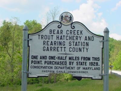
Bear Creek Trout Hatchery and Rearing Station

Photographed By J. J. Prats, June 7, 2006
1. Bear Creek Trout Hatchery and Rearing Station Marker
Maryland Department of Natural Resources website entry
Click for more information.
Click for more information.
One and one-half miles from this point. Purchased by state 1928.
Erected by Conservation Department of Maryland, Swepson Earle, Commissioner.
Topics. This historical marker is listed in this topic list: Agriculture. A significant historical year for this entry is 1928.
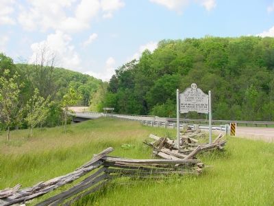
Location. 39° 39.084′ N, 79° 18.042′ W. Marker is near Accident, Maryland, in Garrett County. Marker is at the intersection of Garrett Highway (U.S. 219) and Bear Creek Road, on the right when traveling south on Garrett Highway. Touch for map. Marker is in this post office area: Accident MD 21520, United States of America. Touch for directions.
Other nearby markers. At least 5 other markers are within 2 miles of this marker, measured as the crow flies. Drane House (approx. 1.6 miles away); Zion Ev. Lutheran Church (approx. 1.6 miles away); To the Glory of God (approx. 1.6 miles away); a different marker also named Drane House (approx. 1.7 miles away); a different marker also named Drane House (approx. 1.7 miles away). Touch for a list and map of all markers in Accident.
Regarding Bear Creek Trout Hatchery and Rearing Station. The hatchery is on Fish Hatchery Road, not on Bear Creek Road. The turnoff for Fish Hatchery Road is just around the curve from this sign. Fish Hatchery Road goes east (beside Bear Creek) under the bridge that can be seen in the distance in Photo No. 2.
Credits. This page was last revised on June 4, 2022. It was originally submitted on June 22, 2006, by J. J. Prats of Powell, Ohio. This page has been viewed 2,834 times since then and 66 times this year. Photos: 1, 2. submitted on June 22, 2006, by J. J. Prats of Powell, Ohio.
