Near Forest Ranch in Butte County, California — The American West (Pacific Coastal)
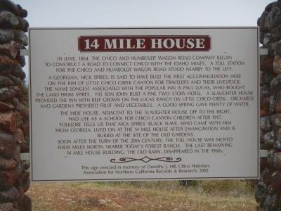
14 Mile House
A Georgian, Nick Spires, is said to have built the first accommodation here on the rim of Little Chico Creek Canyon for travelers and their livestock. The name longest associated with the popular inn is Paul Lucas, who bought the land from Spires. His son John built a fine two-story hotel. A slaughter house provided the inn with beef grown on the Lucas Ranch on Little Chico Creek. Orchards and gardens provided fruit and vegetables. A good spring gave plenty of water.
The hide house, adjacent to the slaughter house off to the right, had use as a school for Chico Canyon children after 1917. Folklore tells us that Nick Spires’ black slave, who came with him from Georgia, lived on at the 14 Mile House after emancipation and is buried at the site of the old gardens. Soon after the turn of the 20th century, the toll house was moved four miles north, nearer today’s Forest Ranch. The last remaining 14 Mile House building, the old barn, disappeared in the 1960s. This sign erected in memory of Dorothy J. Hills, Chico Historian.
Association of Northern California Records and Research
Erected 2002 by Association of Northern California Records and Research.
Topics. This historical marker is listed in these topic lists: Industry & Commerce • Roads & Vehicles. A significant historical month for this entry is June 1864.
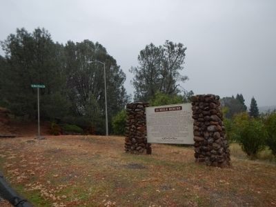
Location. 39° 50.954′ N, 121° 41.544′ W. Marker is near Forest Ranch, California, in Butte County. Marker is at the intersection of Deer Creek Highway (California Route 32) and 14 Mile House Drive on Deer Creek Highway. Touch for map. Marker is in this post office area: Forest Ranch CA 95942, United States of America. Touch for directions.
Other nearby markers. At least 8 other markers are within 8 miles of this marker, measured as the crow flies. Centerville Cemetery (approx. 4.2 miles away); Centerville School (approx. 4.7 miles away); Dogtown (approx. 6.7 miles away); Magalia Community Church / The Magalia Schoolhouse Bell (approx. 6.7 miles away); Lovelock (approx. 6.8 miles away); The Dogtown Nugget (approx. 6.8 miles away); PFC. Steven J. Walberg-Riotto (approx. 7.6 miles away); Old Paradise Depot (approx. 7.6 miles away).
Credits. This page was last revised on June 16, 2016. It was originally submitted on December 12, 2012, by Barry Swackhamer of Brentwood, California. This page has been viewed 1,408 times since then and 103 times this year. Photos: 1, 2. submitted on December 12, 2012, by Barry Swackhamer of Brentwood, California. • Syd Whittle was the editor who published this page.

