Liberty in Clay County, Missouri — The American Midwest (Upper Plains)
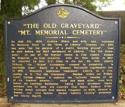
"The Old Graveyard" "Mt. Memorial Cemetery"
Inscription.
On July 5th, 1836, Andrew Hixon and wife, Ann, conveyed by Warranty Deed to the "Town of Liberty" Trustees for $30, one acre, "for the purpose of a public burying ground". Used as such before the 1825 settlement of Liberty. "The Old Graveyard", on one of the highest crests in Clay County, became Mt. Memorial, its first cemetery, with its first burial in 1827. As reported by Hon. D.C. Allen in the Jan 28, 1910 Liberty Tribune, the "Hixon" conveyance created in perpetuity, "a charitable trust" based on a Missouri Territorial Legislature's Act. In 1851, Missouri's legislature "chartered" Liberty as a city; passing to it "The Old Graveyard". Nestled within the William Jewell College campus, it contains the "hallowed remains of all of six hundred persons...", white and black alike, some born before the American Revolution. Among early prominent family members who lie here are Liberty's first Mayor, Madison Miller, William Jewell College's first elected Treasurer (in 1849), Edward M. Samuel, and John Baxter, former "Liberty Landing" proprietor and County Sheriff.
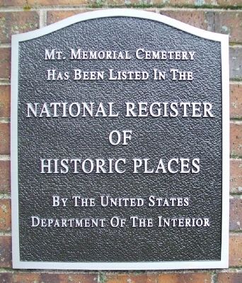
Mt. Memorial Cemetery
has been listed in the
National Register
of Historic Places
by the United States
Department of the Interior
Erected by Native Sons and Daughters of Greater Kansas City.
Topics and series. This historical marker is listed in these topic lists: Cemeteries & Burial Sites • Settlements & Settlers. In addition, it is included in the Kansas City - Native Sons and Daughters of Greater Kansas City series list. A significant historical date for this entry is July 5, 1836.
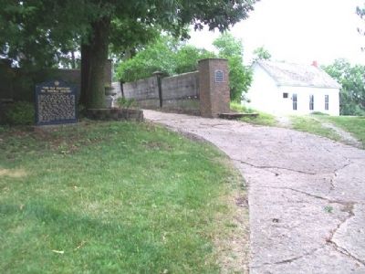
Location. 39° 14.967′ N, 94° 24.755′ W. Marker is in Liberty, Missouri, in Clay County. Marker is at the intersection of Miller Avenue and William Jewell College Drive, on the right when traveling west on Miller Avenue. Markers and cemetery are on the William Jewell College campus. Touch for map. Marker is in this post office area: Liberty MO 64068, United States of America. Touch for directions.
Other nearby markers. At least 8 other markers are within walking distance of this marker. Mass Grave Site (about 300 feet away, measured in a direct line); Civil War Memorial (about 400 feet away); Grand River Baptist Church (about 400 feet away); John Priest Greene President's Home (about 400 feet away); The Trenches On The Hill (about 400 feet away); Goldman-Duckworth House (approx. 0.3 miles away); Frank Hughes Memorial Library (approx. 0.3 miles away); Lightburne Hall (approx. 0.4 miles away). Touch for a list and map of all markers in Liberty.
Also see . . .
1. Mount Memorial Cemetery. National Register of Historic Places Nomination Form (Submitted on August 31, 2013, by William Fischer, Jr. of Scranton, Pennsylvania.)
2. Mount Memorial Cemetery. Find A Grave website entry (Submitted on August 31, 2013, by William Fischer, Jr. of Scranton, Pennsylvania.)
Credits. This page was last revised on February 25, 2024. It was originally submitted on August 31, 2013, by William Fischer, Jr. of Scranton, Pennsylvania. This page has been viewed 888 times since then and 39 times this year. Photos: 1, 2, 3. submitted on August 31, 2013, by William Fischer, Jr. of Scranton, Pennsylvania.


