Charlotte in Dickson County, Tennessee — The American South (East South Central)
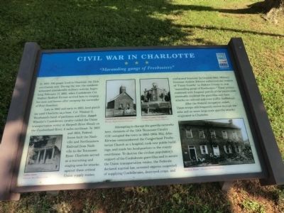
Civil War In Charlotte
"Marauding gangs of Freebooters"
Late in 1862 and early in 1863, local guerillas used Charlotte as a base. Col. Thomas G. Woodward’s band of partisans and Gen. Joseph Wheeler’s Confederate cavalry raided the Union transportation center at Harpeth River Shoals on the Cumberland River, 6 miles northeast. In 1863 and 1864, Federal forces built the Nashville and Northeastern Railroad from Nashville to the Tennessee River. Charlotte served as a recruiting and staging area for attacks against these critical Union supply routes.
Attempting to disrupt the guerilla networks here, elements of the 12th Tennessee Cavalry (US) occupied the town in 1863-1864. Maj. John Kirwine commandeered the Cumberland Presbyterian Church as a hospital, took over public buildings, and made his headquarters in the county courthouse. To destroy the civilian population’s support of the Confederate guerrillas and to secure the Union transportation routes, the Federals declared martial law, arrested citizens suspected of supplying Confederates, destroyed crops, and confiscated livestock. In October 1863, Military Governor Andrew Johnson authorized the creation of “Union Guards” in Dickson County to stop “marauding gangs of Freebooters.” These actions combined with frequent patrols of the country side eventually rendered the guerrillas and their attacks on railroad and river traffic ineffectual.
After the Federal occupation ended, Union troops still frequently moved through the area and no more large-scale guerilla attacks originated in Charlotte.
(captions)
Collier Store Courtesy MaryBaxter Cook
Cumberland Presbyterian Church Courtesy Ragan Family Collection
Dickson County Courthouse Courtesy Ragan Family Collection.
Vorrhies House Courtesy David Stansberry
Erected by Tennessee Civil War Trails.
Topics and series. This historical marker is listed in this topic list: War, US Civil. In addition, it is included in the Former U.S. Presidents: #17 Andrew Johnson, and the Tennessee Civil War Trails series lists. A significant historical date for this entry is February 17, 1722.
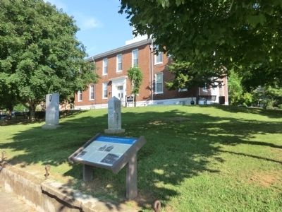
Location. 36° 10.697′ N, 87° 20.354′ W. Marker is in Charlotte, Tennessee, in Dickson County. Marker is on Court Square east of Clark Street, on the left when traveling east. Marker is on the southeast corner of the Dickson County Courthouse grounds. Touch for map. Marker is in this post office area: Charlotte TN 37036, United States of America. Touch for directions.
Other nearby markers. At least 8 other markers are within 7 miles of this marker, measured as the crow flies. To All Who Served (a few steps from this marker); Fighting for Freedom (approx. 2.3 miles away); Promise Land (approx. 2.3 miles away); Robert Nesbit (approx. 2.4 miles away); Hand House (approx. 6.1 miles away); Birth of a Church (approx. 6.1 miles away); The CCC at Montgomery Bell (approx. 6.1 miles away); The Civilian Conservation Corps (approx. 6.1 miles away). Touch for a list and map of all markers in Charlotte.
Credits. This page was last revised on June 16, 2016. It was originally submitted on October 2, 2013, by Don Morfe of Baltimore, Maryland. This page has been viewed 1,100 times since then and 70 times this year. Photos: 1, 2. submitted on October 2, 2013, by Don Morfe of Baltimore, Maryland. • Bernard Fisher was the editor who published this page.

