Adamsville In The Civil War
The Road to Shiloh
— Battle of Shiloh —
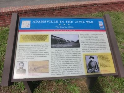
After the February 1862 Union victories at Forts Henry and Donelson, Gen. Don Carlos Buell’s army occupied Nashville while Gen. Ulysses S. Grant’s army penetrated to Pittsburg Landing on the Tennessee River. Buell and Grant planned to attack the rail center of Corinth, Mississippi, but on April 6, Confederate Gen. Albert Sidney Johnston struck first. The Battle of Shiloh was a near Confederate victory the first day, although Johnston was killed. On the second day, Grant’s counterattack succeeded, and the Confederates retreated to Corinth. Shiloh was the war’s bloodiest battle to date, with almost 24,000 killed, wounded or missing.
By early in March 1862, after Union Gen. Ulysses S. Grant moved his army to southern Tennessee, three units of Federal troops under Gen. Lewis “Lew” Wallace were stationed at Adamsville, Stoney Lonesome, and Crump’s Landing. Wallace gained a reputation for fairness even among local Confederate supporters as he purchased fodder and supplies for his forces.
On April 1, Lt. Charles H. Murray, 5th Ohio Cavalry, reported to Wallace that a skirmish near Adamsville went badly for the Federals when his small detachment suffered “a rapid and severe fire from (Confederate) double-barreled shot-guns. This our men returned with spirit, nor did a man flinch until they had emptied their carbines
and pistols.” Murray complained that the Confederates had outgunned them: “Every engagement of our cavalry with theirs, under our present poorly-armed condition, must prove disastrous. Our men are brave. They ask for good arms; they deserve them. They say, ‘Give us good weapons and we will fight to the death.” Five days later, when the bloodbath at Shiloh began, Murray’s men had their chance to fight to the death.The troops here took part in Wallace’s frustrated attempts to reach the Shiloh battlefield on April 6. His orders were confusing and the roads were difficult. Wallace’s command did not arrive until 7 p.m., and his alleged “dilatoriness” was one of the war’s early controversies. However, his 11,000 men helped turn the tide in favor of the Union on April 7.
(Inscription under the photo in the lower left)
Gen. Ulysses S. Grant-Courtesy of Library of Congress (Inscription under the photo in the lower left)
Cavalry skirmishing with rifles-Courtesy Library of Congress.
(Inscription in the photo in the upper center)
Adamsville, with Bethel Springs-Purdy-Adamsville stage road, 1920—Courtesy Bill Wagoner
(Inscription next to the photo in the lower right
Gen. Lew Wallace-Courtesy Library of Congress.
Side bar-(next to Wallace photo)
In 1864, at the Battle of Monocacy, Maryland, Gen. Lew Wallace stalled
Erected by Tennessee Civil War Trails.
Topics and series. This historical marker is listed in this topic list: War, US Civil. In addition, it is included in the Tennessee Civil War Trails series list. A significant historical month for this entry is February 1862.
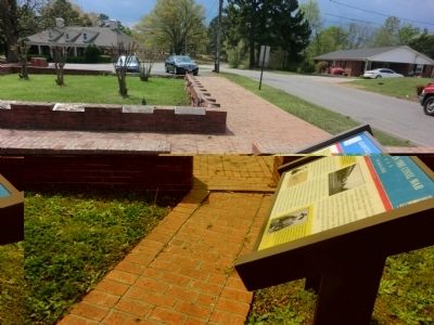
Location. 35° 14.148′ N, 88° 23.706′ W. Marker is in Adamsville, Tennessee, in McNairy County. Marker is at the intersection of West Main Street and Baptist Street on West Main Street. Touch for map. Marker is in this post office area: Adamsville TN 38310, United States of America. Touch for directions.
Other nearby markers. At least 8 other markers are within 6 miles of this marker, measured as the crow flies. Approach to Shiloh (approx. half a mile away); Buford Pusser Memorial Park (approx. ¾ mile away); October 4th 1969 (approx. 1.3 miles away); a different marker also named Approach to Shiloh (approx. 2 miles away); a different marker also named Approach to Shiloh (approx. 2 miles away); Buford Hayse Pusser (approx. 4.2 miles away); Memorial to Veterans (approx. 5.7 miles away); a different marker also named Approach to Shiloh (approx. 5.8 miles away). Touch for a list and map of all markers in Adamsville.
Credits. This page was last revised on June 16, 2016. It was originally submitted on June 27, 2014, by Don Morfe of Baltimore, Maryland. This page has been viewed 1,101 times since then and 57 times this year. Photos: 1, 2. submitted on June 27, 2014, by Don Morfe of Baltimore, Maryland. • Bill Pfingsten was the editor who published this page.

