Memphis in Hall County, Texas — The American South (West South Central)
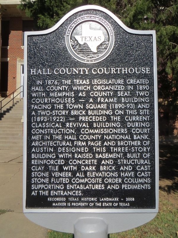
Hall County Courthouse
Photographed by Bill Kirchner, November 15, 2016
1. Hall County Courthouse Marker
Marker is property of the State of Texas
Erected 2008 by Texas Historical Commission. (Marker Number 2337.)
Topics. This historical marker is listed in this topic list: Notable Buildings. A significant historical year for this entry is 1876.
Location. 34° 43.473′ N, 100° 32.189′ W. Marker is in Memphis, Texas, in Hall County. It is on Noel Street west of South 5th Street, on the right when traveling west. Touch for map.
this page online

Regionally, this marker is on the Texas Panhandle. It is also on the American Great Plains and specifically on the Southern Plains. Globally, it is in North America, a Gulf of Mexico state, the Western Hemisphere, the Western World, and the Anglosphere. Historically, it finds itself in what was once New Spain, the Comanchería, the Dust Bowl, the Republic of Texas, and one of the Confederate States of America.
Other nearby markers. At least 8 other markers are within 10 miles of this marker, measured as the crow flies: Hall County (about 300 feet away, measured in a direct line); First Presbyterian Church of Memphis (approx. 0.2 miles away); Quanah Parker Trail (approx. 0.4 miles away); a different marker also named Hall County (approx. half a mile away); Old Fairview Cemetery (approx. ¾ mile away); George Marece Berry (approx. one mile away); Shoe Bar Ranch Headquarters (approx. 9.2 miles away); Newlin Cemetery (approx. 9.8 miles away). Touch for a list and map of all markers in Memphis.
Photographed by Bill Kirchner, November 15, 2016
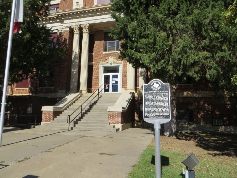
2. Hall County Courthouse Marker
Photographed by Bill Kirchner, November 15, 2016
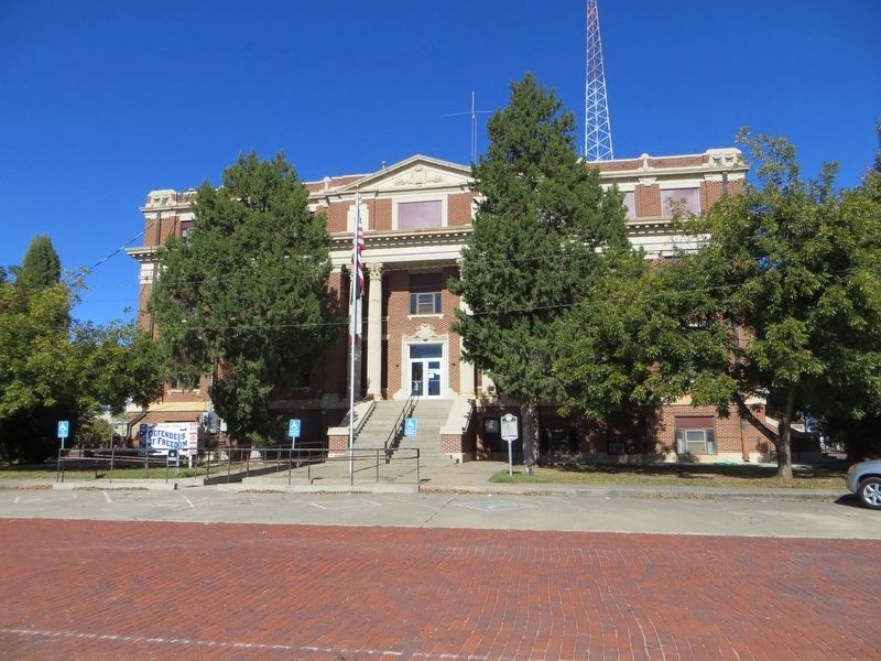
3. Hall County Courthouse
Credits. This page was last revised on November 30, 2016. It was originally submitted on November 30, 2016, by Bill Kirchner of Tucson, Arizona. This page has been viewed 638 times since then and 34 times this year. Photos: 1, 2, 3. submitted on November 30, 2016, by Bill Kirchner of Tucson, Arizona.
