Opening the Floodgates
[Inset]
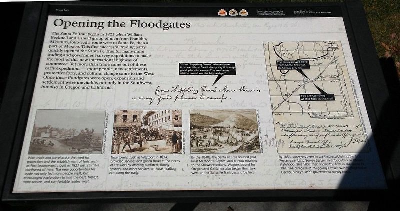
"from 'Sappling Grove' where there is an excellent fountain spring & a very good place to camp.. The road runs a little round on the high ridge."
The Santa Fe Trail began in 1821 when William Becknell and a small group of men from Franklin, Missouri, followed a route west to Santa Fe, then a part of Mexico. This first successful trading party quickly opened the Santa Fe Trail for many more trading and government survey expeditions to make the most of this new international highway of commerce. Yet more than trade came out of these early expeditions — more people, new settlements, protective forts, and cultural change came to the West. Once these floodgates were open, expansion and settlement were inevitable, not only in the Southwest, but also in Oregon and California.
[Image captions, from left to right, read]
With trade and travel arose the need for protection and the establishment of forts such as Fort Leavenworth, built in 1827 just 35 miles northwest of here. The new opportunities for trade not only led more people west, but encouraged exploration to find the best, fastest, most secure, and comfortable routes west.
Courtesy of Kansas State Historical Society
New towns, such as Westport in 1834, provided services and goods to meet the needs of
travelers by offering outfitters, hotels, grocers, and other service to those heading out along the trails.Artwork by Tom Phillips
By the 1840s, the Santa Fe Trail coursed past local Methodist, Baptist, and Friends missions to the Shawnee Indians. Wagons bound for Oregon and California also began their trek west on the Santa Fe Trail, passing by here.
[Drawing] Josiah Gregg, Commerce of the Prairies, 1844.
By 1854, surveyors were in the field establishing the U.S. Rectangular Land Survey System in anticipation of Kansas statehood. This 1857 map shows the fork in the Santa Fe Trail. The campsite at "Sappling Grove" was highlighted in George Sibley's 1827 government survey notes.
Map, Kansas State Historical Society; surveyor's notes, Missouri Historical Society.
[Map inset reads] You are standing at this fork in the trail
Erected by Kansas City Area Historic Trails Association and the National Park Service.
Topics and series. This historical marker is listed in these topic lists: Exploration • Industry & Commerce • Roads & Vehicles • Settlements & Settlers. In addition, it is included in the California Trail, the Oregon Trail, and the Santa Fe Trail series lists. A significant historical year for this entry is 1821.
Location.
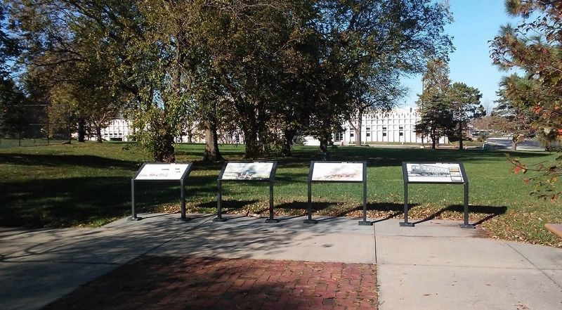
Other nearby markers. At least 8 other markers are within 2 miles of this marker, measured as the crow flies. Voices from the Trail (here, next to this marker); Two Routes from Westport (here, next to this marker); Wagons and Coaches... ...to Trains and Planes (here, next to this marker); Heritage of Johnson County, Kansas (approx. 1.7 miles away); Wilson-Weldon Buildings (approx. 1.8 miles away); A. M. Wood Buildings (approx. 1.8 miles away); Conser Store & Hall (approx. 1.8 miles away); William B. Strang, Jr. (approx. 1.8 miles away). Touch for a list and map of all markers in Overland Park.
Also see . . .
1. Santa Fe National Historic Trail. (Submitted on December 6, 2016, by William Fischer, Jr. of Scranton, Pennsylvania.)
2. Oregon National Historic Trail. (Submitted on December 6, 2016, by William Fischer, Jr. of Scranton, Pennsylvania.)
3. California National Historic Trail. (Submitted on December 6, 2016, by William Fischer, Jr. of Scranton, Pennsylvania.)
4. Shawnee Indian Mission State Historic Site. (Submitted on December 6, 2016, by William Fischer, Jr. of Scranton, Pennsylvania.)
5. Kansas City Area Historic Trails Association. (Submitted on December 6, 2016, by William Fischer, Jr. of Scranton, Pennsylvania.)
Credits. This page was last revised on December 6, 2016. It was originally submitted on December 5, 2016, by William Fischer, Jr. of Scranton, Pennsylvania. This page has been viewed 379 times since then and 18 times this year. Photos: 1, 2. submitted on December 5, 2016, by William Fischer, Jr. of Scranton, Pennsylvania.

