Near Tequila, Jalisco, Mexico — The Pacific Coast (and Central Highlands)
Tequila: Symbol of Mexico
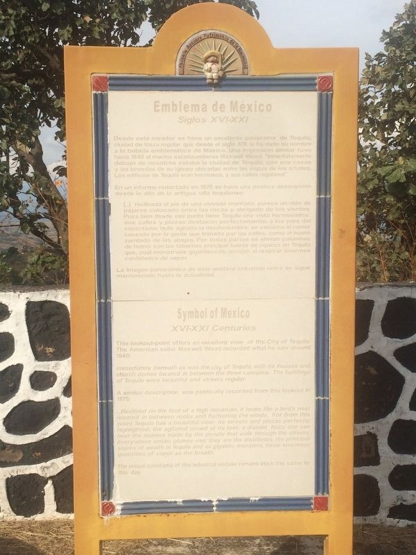
Siglos XVI-XXI
En un informe redactado en 1875 se hace una poética descripción desde lo alto de la antigua villa tequilense.
[…] reclinada al pie de una elevada montaña, parece un nido de pájaros colocado entre las rocas y abrigado de los vientos. Pues bien desde ese punto tiene Tequila una vista hermosísima: sus calles y plazas destacan perfectamente; a los pies del espectador bulle agitada la muchedumbre; se escucha el rumor causado por la gente que transita por las calles, como el lejano zumbido de las abejas. Por todas partes se elevan columnas de humo: son las tabernas, principal fuente de riqueza en Tequila que, cual monstruos gigantescos, arrojan al respirar enormes cantidades de vapor.
La imagen panorámica de este enclave industrial único se sigue manteniendo hasta la actualidad.
XVI-XXI Centuries
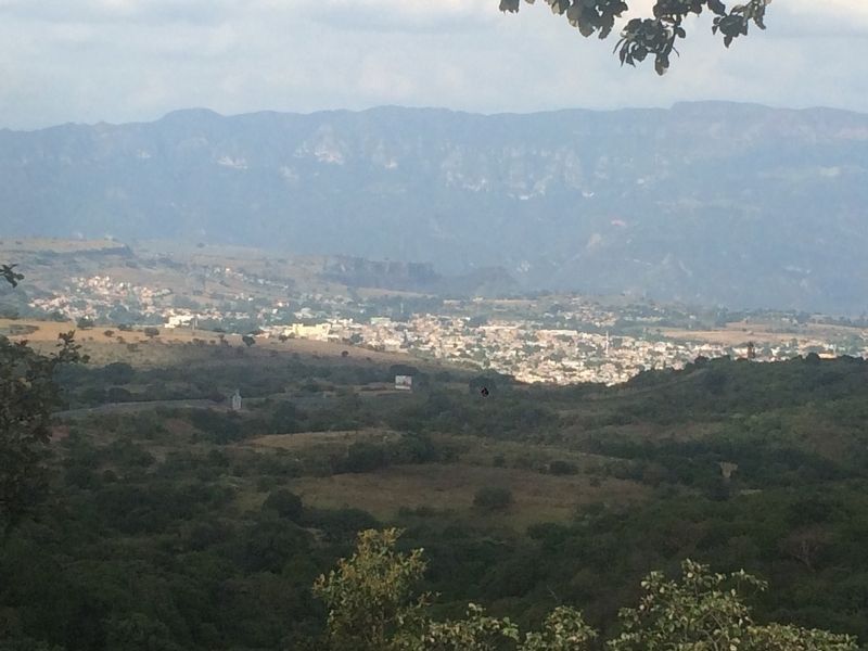
Immediately below us was the city of Tequila, with its houses and church domes located among the nearby trees. The buildings of Tequila were beautiful and its streets regular.
A similar description was poetically recorded from this lookout in 1875:
…Reclined on the foot of a high mountain, it looks like a bird’s nest located in between rocks and harboring the winds. For from this point Tequila has a beautiful view: its streets and plazas perfectly highlighted; the agitated crowd at its feet; a distant buzz, one can hear the murmur made by the people that walk through the streets. Everywhere smoke plumes rise: they are the distilleries, the principal source of wealth in Tequila and as gigantic monsters, throw enormous quantities of vapor as the breath.
The unique panorama of this industrial enclave remains much the same to this day.
Topics and series. This historical marker is listed in this topic list: Industry & Commerce
. In addition, it is included in the UNESCO World Heritage Sites series list. A significant historical year for this entry is 1840.
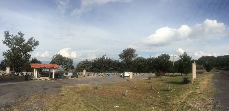
Location. 20° 50.93′ N, 103° 51.222′ W. Marker is near Tequila, Jalisco. Marker is on Carretera Federal 15D, on the right when traveling west. The markers are located at a rest stop off of the Guadalajara-Tepic toll road, about one kilometer before the turnoff to the city of Tequila. Touch for map. Marker is in this post office area: Tequila JAL 46400, Mexico. Touch for directions.
Additional commentary.
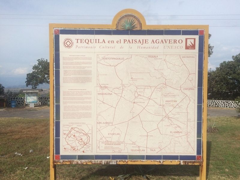
1. Addtional text on The Exceptional Agave Landscape/La Excepcionalidad del Paisaje Agavero marker
Since ancient times the people of this region have modified the landscape and original vegetation to adapt them to the cultivation of blue agave, giving the zone a unique character that has been complemented with numerous distilleries scattered in the valleys to produce the famous mezcal of Tequila.
This unique landscape and historic industrial
facilities were inscribed in the list of World Heritage Sites by UNESCO (United Nations Education, Science and
Cultural Organization) on the basis of several criteria, including:
The agave landscape exemplifies the continuous link between the ancient Mesoamerican culture of the agave and today, as well as the continuous process of cultivation since the 17th century when large scale plantations were created and distilleries first started production of tequila. The overall landscape of fields, distilleries, haciendas and towns is an outstanding example of a traditional human settlement and land-use which is representative of a specific culture that developed in Tequila.
This unique ecosystem is framed by two impressive geological boundaries: the deep canyon that descends to the shores of the Rio Grande de Santiago to the north and the impressive Sacred Mountain, the Volcano of Tequila, to the south. The area also includes archeological sites from the Teuchitlan cultural with their
unique circular pyramids, in addition to the numerous ex-haciendas and the historic tequila installations. Together these sites and the exceptional blue agave landscape make this a enchanting area.
Recorrer la región agavera de Tequila permite conocer uno de los paisajes más espectaculares que ofrece Jalisco. Sólo basta internarse en esta comarca de superficie pequeña y localizada a pocos kilómetros de Guadalajara, entre los municipios de Magdalena, Tequila, Amatitán y El Arenal. El paseo ofrece entre sus
atractivos establecer contacto con una de las actividades que ha marcado con su sello distintivo la identidad de los mexicanos: la industria tequilera.
Desde épocas remotas, los pobladores de este territorio fueron modificando el entorno agreste y la flora originaria para adaptarlos al cultivo del agave azul, dando a la zona un carácter único que se complementa con las numerosas destilerías que lo salpican y sus procesos tradicionales para la producción del famoso tequila.
Este paisaje cultural único en el mundo fue inscrito en la Lista del Patrimonio Mundial de la Organización de las Naciones Unidas para la Educación, la Ciencia y la Cultura (UNESCO), el 12 de julio de 2006, tomando en consideración su valor universal excepcional:
El paisaje agavero ejemplifica el vínculo continuo entre la antigua cultura mesoamericana del agave y el presente, así como el continuo proceso de cultivo desde el siglo XVII cuando se establecen las primeras plantaciones intensivas y las destilerías inician la producción de tequila. El paisaje constituido por campos
agaveros, destilerías, haciendas y poblados es un ejemplo excepcional de un asentamiento humano tradicional y un uso de la tierra que es representativo de la cultura especifica que se desarrolló en Tequila.
El ecosistema donde se insertan los plantíos agaveros está enmarcado por dos accidentes geológicos sorprendentes: el profundo cañón que desciende hasta el cauce del río Grande de Santiago, hacia su confín norte, y la imponente presencia de la antigua Montaña Sagrada del Cerro Grande o volcán de Tequila, hacia
el sur. En el aspecto cultural, la comarca cuenta con el sitio arqueológico de los Guachimontones, aún en proceso de investigación; diversas haciendas e instalaciones tequileras añejas; varias poblaciones históricas, y el excepcional paisaje constituido por los sembradíos del Agave tequilana Weber, variedad azul.
— Submitted December 9, 2016, by J. Makali Bruton of Accra, Ghana.
Credits. This page was last revised on February 11, 2020. It was originally submitted on December 8, 2016, by J. Makali Bruton of Accra, Ghana. This page has been viewed 325 times since then and 13 times this year. Photos: 1, 2, 3, 4. submitted on December 8, 2016, by J. Makali Bruton of Accra, Ghana.


