Near McLean in Gray County, Texas — The American South (West South Central)
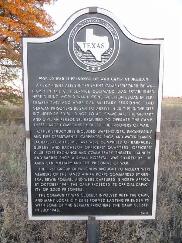
World War II Prisoner of War Camp at McLean
Photographed by Bill Kirchner, November 16, 2016
1. World War II Prisoner of War Camp at McLean Marker
Other structures included warehouses, engineering and fire departments, carpenter shop, and water plants. Facilities for the military were comprised of barracks, nurses' and bachelor officers' quarters, officers' club, post exchange and commissary, theater, laundry, and barber shop. A small hospital was shared by the American military and the prisoners of war.
The first group of prisoners brought to McLean were members of the famed Afrika Korps commanded by General Erwin Rommel and were captured in North Africa. By October 1944 the camp exceeded its official capacity of 3,000 prisoners.
The community was closely involved with the camp, and many local citizens formed lasting friendships with some of the German prisoners.
this page online
Erected 1997 by Texas Historical Commission. (Marker Number 5908.)
Topics. This historical marker is listed in this topic list: War, World II. A significant historical month for this entry is July 1943.
Location. 35° 14.481′ N, 100° 32.335′ W. Marker is near McLean, Texas, in Gray County. It is at the intersection of County Line Road and Gray Z Road, on the left when traveling north on County Line Road. Marker is 0.8 miles north of I-40. Touch for map. Marker is in this post office area: McLean TX 79057, United States of America. Touch for directions.

Regionally, this marker is on the Texas Panhandle. It is also on the American Great Plains and specifically on the Southern Plains. Globally, it is in North America, a Gulf of Mexico state, the Western Hemisphere, the Western World, and the Anglosphere. Historically, it finds itself in what was once New Spain, the Comanchería, the Dust Bowl, the Republic of Texas, and one of the Confederate States of America.
Other nearby markers. At least 8 other markers are within 11 miles of this marker, measured as the crow flies: Devil's Rope Museum, McLean, Texas
Photographed by Bill Kirchner, November 16, 2016
2. World War II Prisoner of War Camp at McLean Marker
Another marker is no longer nearby. Phillips 66 Service Station, McLean, Texas (was approx. 3.6 miles away but has been confirmed missing).
Also see . . . Texas Escapes article on the McLean POW Camp. (Submitted on December 10, 2016, by Mark Hilton of Montgomery, Alabama.)
Photographed by Bill Kirchner, November 16, 2016
3. World War II Prisoner of War Camp at McLean Marker
Credits. This page was last revised on December 12, 2016. It was originally submitted on December 10, 2016, by Bill Kirchner of Tucson, Arizona. This page has been viewed 3,996 times since then and 317 times this year. Photos: 1, 2, 3. submitted on December 10, 2016, by Bill Kirchner of Tucson, Arizona.
