Near Morgan Hill in Santa Clara County, California — The American West (Pacific Coastal)
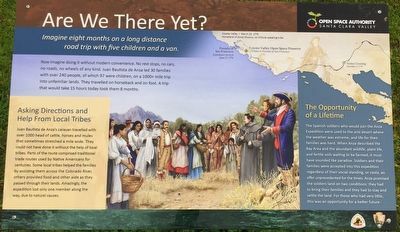
Are We There Yet?
Now imagine doing it without modern convenience. No rest stops, no cars, no roads, no wheels of any kind. Juan Bautista de Anza led 30 families with over 240 people, of which 97 were children, on a 1000+ mile trip into unfamiliar lands. They traveled on horseback and on foot. A trip that would take 15 hours today took them 8 months.
Juan Bautista de Anza's caravan travelled with over 1000 head of cattle, horses and mules that sometimes stretched a mile wide. They could not have done it without the help of local tribes. Parts of the route comprised traditional trade routes used by Native Americans for centuries. Some local tribes helped the families by assisting them across the Colorado River, others provided food and other aide as they passed trough their lands. Amazingly, the expedition lost only one member along the way, due to natural causes.
The Spanish soldiers who would join the Anza Expedition were used to the arid desert where the weather was extreme, and life for their families was hard. When Anza described the Bay Area and the abundant wildlife, plant life, and fertile soils waiting to be farmed, it must have sounded like paradise. Soldiers and their families were accepted into the expedition regardless of their social standing, or casta, an offer unprecedented for the times. Anza promised the soldiers land on two conditions: they had to bring their families and they had to stay and settle the land. For those who had very little, this was an opportunity for a better life.
Erected by Santa Clara Valley Open Space Authority.
Topics and series. This historical marker is listed in these topic lists: Exploration • Settlements & Settlers. In addition, it is included in the Juan Bautista de Anza National Historic Trail series list. A significant historical date for this entry is February 25, 1776.
Location. 37° 10.258′ N, 121° 43.637′ W. Marker is near Morgan Hill, California, in Santa Clara County. Marker is on Palm Avenue near Valley Oaks Drive. Touch for map. Marker is at or near this postal address: 599 Palm Avenue, Morgan Hill CA 95037, United States of America. Touch for directions.
Other nearby markers. At least 8 other markers are within 5 miles of this marker, measured as the crow flies. Calero County Park – Bailey Fellows House (approx. 1.9 miles away); Madrone (approx. 3.2 miles away); Town of Coyote (approx. 3.3 miles away); Morgan Hill Historical Museum (approx. 4.6 miles away); Virginia Mae Days (approx. 4.6 miles away); Nob Hill Foods (approx. 4.6 miles away); First Trafffic Light (approx. 4.6 miles away); Live Oak Emerald Regime Band & Color Guard (approx. 4.6 miles away). Touch for a list and map of all markers in Morgan Hill.
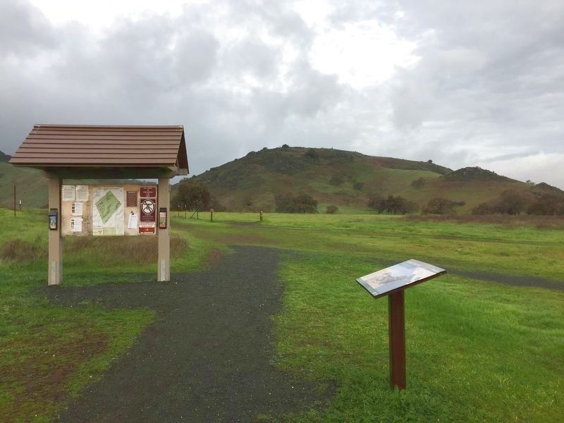
More about this marker. This marker is located near the Coyote Valley Open Space Preserve parking lot.
Also see . . . Juan Bautista de Anza National Historic Trail. On the eve of the American Revolution, Lt. Colonel Juan Bautista de Anza led more than 240 men, women, and children on an epic journey across the frontier of New Spain to establish a settlement at San Francisco Bay.(Submitted on December 10, 2016, by Barry Swackhamer of Brentwood, California.)
Credits. This page was last revised on December 10, 2016. It was originally submitted on December 10, 2016, by Barry Swackhamer of Brentwood, California. This page has been viewed 274 times since then and 12 times this year. Photos: 1, 2. submitted on December 10, 2016, by Barry Swackhamer of Brentwood, California.

