Falls in Wyoming County, Pennsylvania — The American Northeast (Mid-Atlantic)
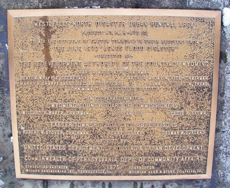
West Falls North Disaster Urban Renewal Area
Project No. PA. R-676 (C)
Inscription.
the June 1972 "Agnes Flood Disaster"
- Executed by -
the Redevelopment Authority of the County of Wyoming
[officers not transcribed]
- In cooperation with -
Wyoming County Board of Supervisors
[officers not transcribed]
- Funded by -
United States Department of Housing & Urban Development
- and -
Commonwealth of Pennsylvania Dept. of Community Affairs
Erected 1975 by Wyoming County Redevelopment Authority and Board of Supervisors, US HUD, and PA Dept of Community Affairs.
Topics. This historical marker is listed in this topic list: Disasters. A significant historical month for this entry is June 1972.
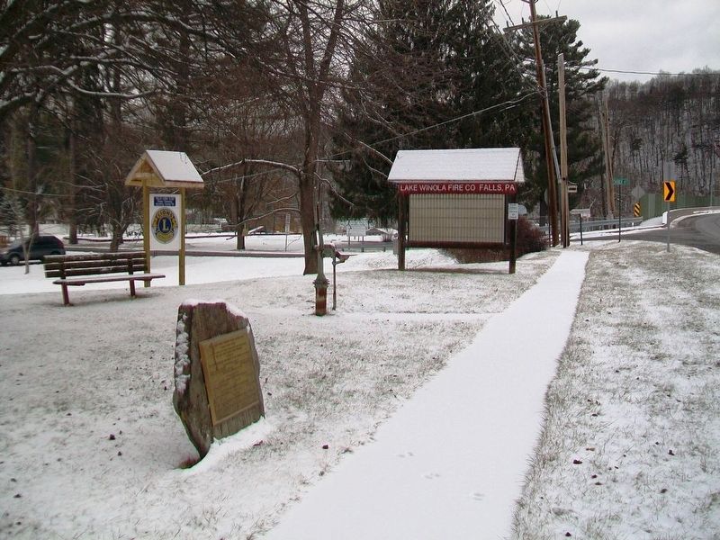
Location. 41° 27.61′ N, 75° 51.377′ W. Marker is in Falls, Pennsylvania, in Wyoming County. Marker is at the intersection of Pennsylvania Route 92 and Woodside Drive, on the left when traveling north on State Route 92. Touch for map. Marker is in this post office area: Falls PA 18615, United States of America. Touch for directions.
Other nearby markers. At least 8 other markers are within 8 miles of this marker, measured as the crow flies. Veterans Memorial (a few steps from this marker); Wyolutimunk (approx. 2.2 miles away); Sullivan's March (approx. 2.4 miles away); a different marker also named Veterans Memorial (approx. 6.8 miles away); a different marker also named Veterans Memorial (approx. 6.8 miles away); Tunkhannock (approx. 7.1 miles away); Discover Tunkhannock (approx. 7.2 miles away); The Sullivan Expedition Against the Iroquois Indians, 1779 (approx. 7.2 miles away). Touch for a list and map of all markers in Falls.
Also see . . .
1. Tropical Storm Agnes in the Susquehanna Basin. (Submitted on January 18, 2017, by William Fischer, Jr. of Scranton, Pennsylvania.)
2. Hurricane Agnes Photo Gallery. (Submitted on January 18, 2017, by William Fischer, Jr. of Scranton, Pennsylvania.)
3. Susquehanna River, PA Hurricane Agnes Flood of 1972. (Submitted on January 18, 2017, by William Fischer, Jr. of Scranton, Pennsylvania.)
Credits. This page was last revised on January 18, 2017. It was originally submitted on January 18, 2017, by William Fischer, Jr. of Scranton, Pennsylvania. This page has been viewed 246 times since then and 19 times this year. Photos: 1, 2. submitted on January 18, 2017, by William Fischer, Jr. of Scranton, Pennsylvania.

