
Grand Island in Erie County, New York — The American Northeast (Mid-Atlantic)
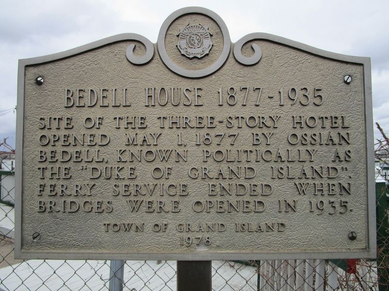
Bedell House 1877 - 1935
Photographed by Anton Schwarzmueller, January 27, 2017
1. Bedell House 1877 - 1935 Marker
Site of the three-story hotel
opened May 1, 1877 by Ossian
Bedell, known politically as
the "Duke of Grand Island".
Ferry service ended when
bridges were opened in 1935.
Erected 1978 by Town of Grand Island.
Topics. This historical marker is listed in this topic list: Notable Buildings. A significant historical date for this entry is May 1, 1877.
Location. 42° 58.34′ N, 78° 56.66′ W. Marker is on Grand Island, New York, in Erie County. It is at the intersection of Ferry Road and East River Road, on the left when traveling east on Ferry Road. Marker is at the foot of Ferry Road. Touch for map. Marker is at or near this postal address: 1437 Ferry Road, Grand Island NY 14072, United States of America. Touch for directions.

Regionally, this marker is in Upstate New York, specifically in Western New York, and in the Buffalo Metropolitan Area. It is also in the American Northeast, on the Great Lakes, and in the Mid-Atlantic. Globally, it is in the North Atlantic Region, North America, the Western Hemisphere, the Western World, and the Anglosphere. Historically, it finds itself in what was
this page online
Other nearby markers. At least 8 other markers are within walking distance of this marker: Grover Cleveland & Grand Island / Lewis F. Allen & Western New York (approx. 0.8 miles away); Allenton Farm/Creating Beaver Island State Park (approx. 0.8 miles away); A Home for Fish (approx. one mile away); Management (approx. one mile away); Recovery (approx. one mile away); Did You Ever Wonder What It Takes to Restore an Island? (approx. one mile away); Island Life (approx. one mile away); Strawberry Island (approx. one mile away). Touch for a list and map of all markers in Grand Island.
Regarding Bedell House 1877 - 1935. The "bridges" referred to on the marker are the Grand Island bridges, one south and one north. Both were twinned to carry the present I-190 across Grand Island.
Also see . . . Grand Island's lost and forgotten gilded age. Niagara Frontier Publications website entry (Submitted on January 2, 2022, by Larry Gertner of New York, New York.)
Photographed by Anton Schwarzmueller, January 27, 2017
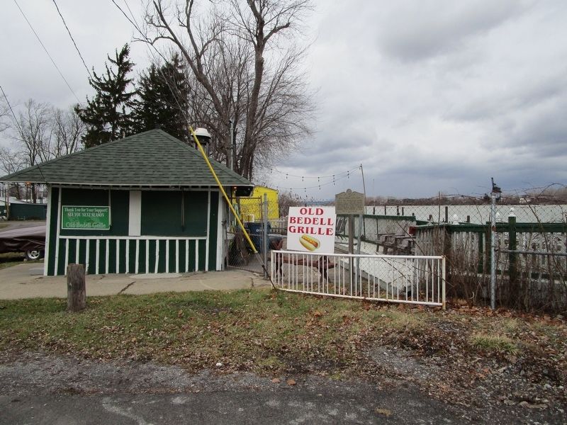
2. Bedell House 1877 - 1935 Marker at Center
Foot of Ferry Road.
Photographed by Anton Schwarzmueller, January 27, 2017
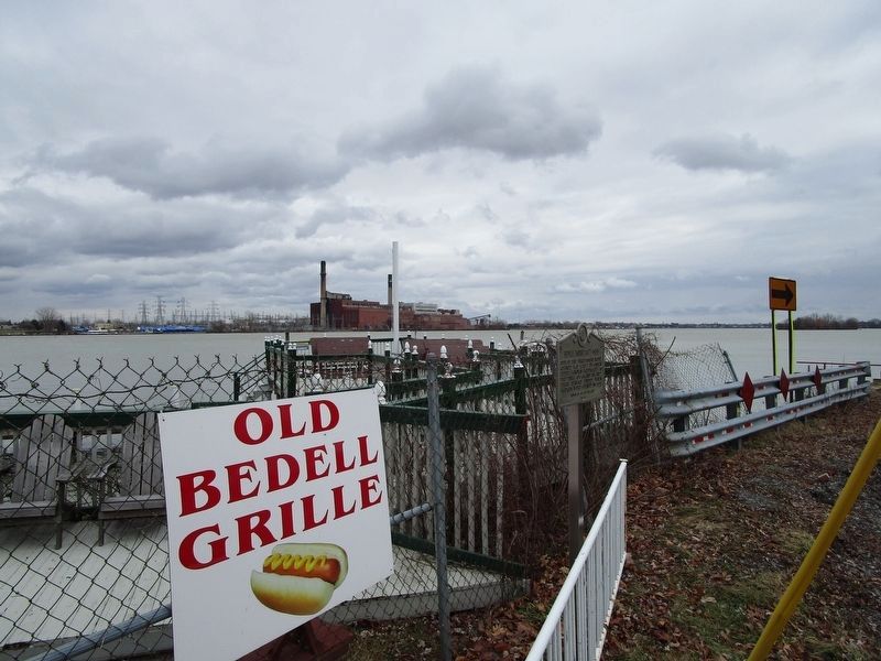
3. Bedell House 1877 - 1935 Marker at Center
This is the east branch of the Niagara River. The shut-down Huntley power plant (coal fired) in Tonawanda is on the far shore. Tiny Motor Island is to the right. (Pirate Island on Google Maps.)
Credits. This page was last revised on January 2, 2022. It was originally submitted on January 28, 2017, by Anton Schwarzmueller of Wilson, New York. This page has been viewed 2,010 times since then and 101 times this year. Photos: 1, 2, 3. submitted on January 28, 2017, by Anton Schwarzmueller of Wilson, New York.
