Greenville in Greenville County, South Carolina — The American South (South Atlantic)
Vardry Mill
| — | Reedy River Historic Park | — |
Photographed by Ronald Miller, August 10, 2008
1. Vardry Mill Marker
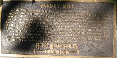
In 1874 Vardy McBee's heirs leased and renovated an old grain mill on this property to Massachusetts natives O.H. Sampson and George Hall. First called Sampson, Hall & Co., by its founders, the textile mill consisted of two, three-story buildings each forty by twenty-eight-feet. Its stone foundations are clearly visible. The mill initially employed between fifty and sevety-five workers. Its 4,000 spindles spun cotton yarn for knitting and crocheting. It became Camperdown Number One when Sampson and Hall opened the Camperdown Mill on the north bank in 1876. In 1885, when Henry P. Hammett purchased the Camperdown Mill. O.H. Sampson transferred its machinery to a new mill outside the city limits which later became the American Spinning Company. In 1906 Camperdown Number One was sold to Luther McBee, re-equipped, and renamed the Vardry Mill.
Topics. This historical marker is listed in this topic list: Industry & Commerce. A significant historical year for this entry is 1874.
Location. 34° 50.625′ N, 82° 24.012′ W. Marker is in Greenville, South Carolina, in Greenville County. It is on Furman College Way, on the left when traveling
this page online

Regionally, this marker is in Upstate. It is also in the American South, specifically in the Deep South, in Appalachia, and specifically in Southern Appalachia. Globally, it is in North America, the Western Hemisphere, the Western World, and the Anglosphere. Historically, it finds itself in what was once the original Cherokee Nation, the territory of the Mississippian Culture, one of the original Thirteen Colonies, one of the Confederate States of America, and the Antebellum South.
Other nearby markers. At least 10 other markers are within walking distance of this marker: Reedy River Falls (a few steps from this marker); Old Mill Ruins (a few steps from this marker); The Cherokees (within shouting distance of this marker); Mill Village (within shouting distance of this marker); Furman University
Photographed by Ronald Miller, August 10, 2008
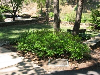
2. Vardry Mill Marker Location
Another marker is no longer nearby. Falls Reclaimed and the Liberty Bridge 2004 (was about 400 feet away but has been replaced with another marker now near it).
Additional keywords. Greenville,Industry,Textile
Photographed by Ronald Miller, August 11, 2008
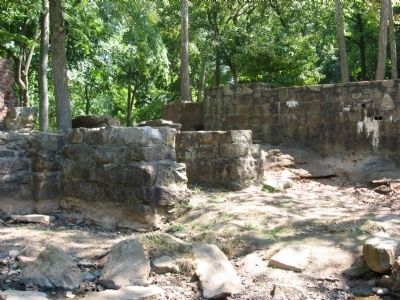
3. Vardry Mill Ruins
Photographed by Brian Scott, December 7, 2008
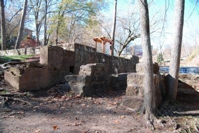
4. Vardry Mill Ruins

Photographed by Brian Scott, December 7, 2008
5. Vardry Mill Ruins
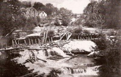
Coxe Collection, Greenville County Historical Society, circa 1915
6. Reedy River Falls and Vardry Mill
The two buildings to the far left were build by Vardry McBee.
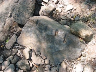
Photographed by Ronald Miller, August 10, 2008
7. Tool marks on boulder in the riverbed.
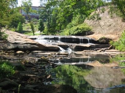
Photographed by Ronald Miller, August 10, 2008
8. Riverbed above the mill ruins.
Credits. This page was last revised on June 16, 2016. It was originally submitted on August 11, 2008, by Ronald Miller of Gray Court, South Carolina. This page has been viewed 2,071 times since then and 71 times this year. Photos: 1, 2, 3. submitted on August 11, 2008, by Ronald Miller of Gray Court, South Carolina. 4, 5. submitted on December 20, 2008, by Brian Scott of Anderson, South Carolina. 6. submitted on April 15, 2009, by Brian Scott of Anderson, South Carolina. 7, 8. submitted on August 11, 2008, by Ronald Miller of Gray Court, South Carolina. • Craig Swain was the editor who published this page.
